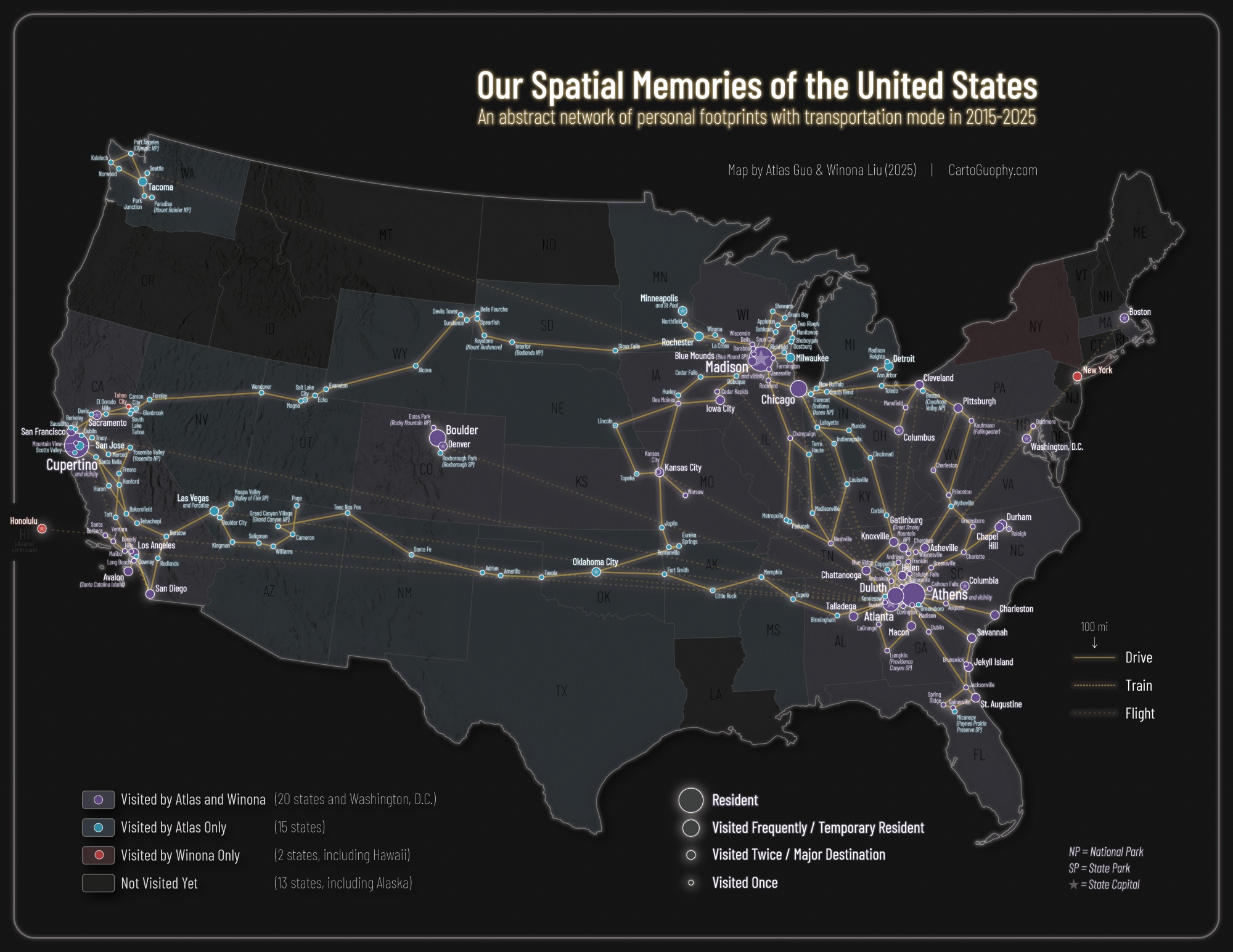
Our Spatial Memories of the United States
An abstract network of personal footprints with transportation mode since 2015
 Download Compressed Image
Download Full-Size Image
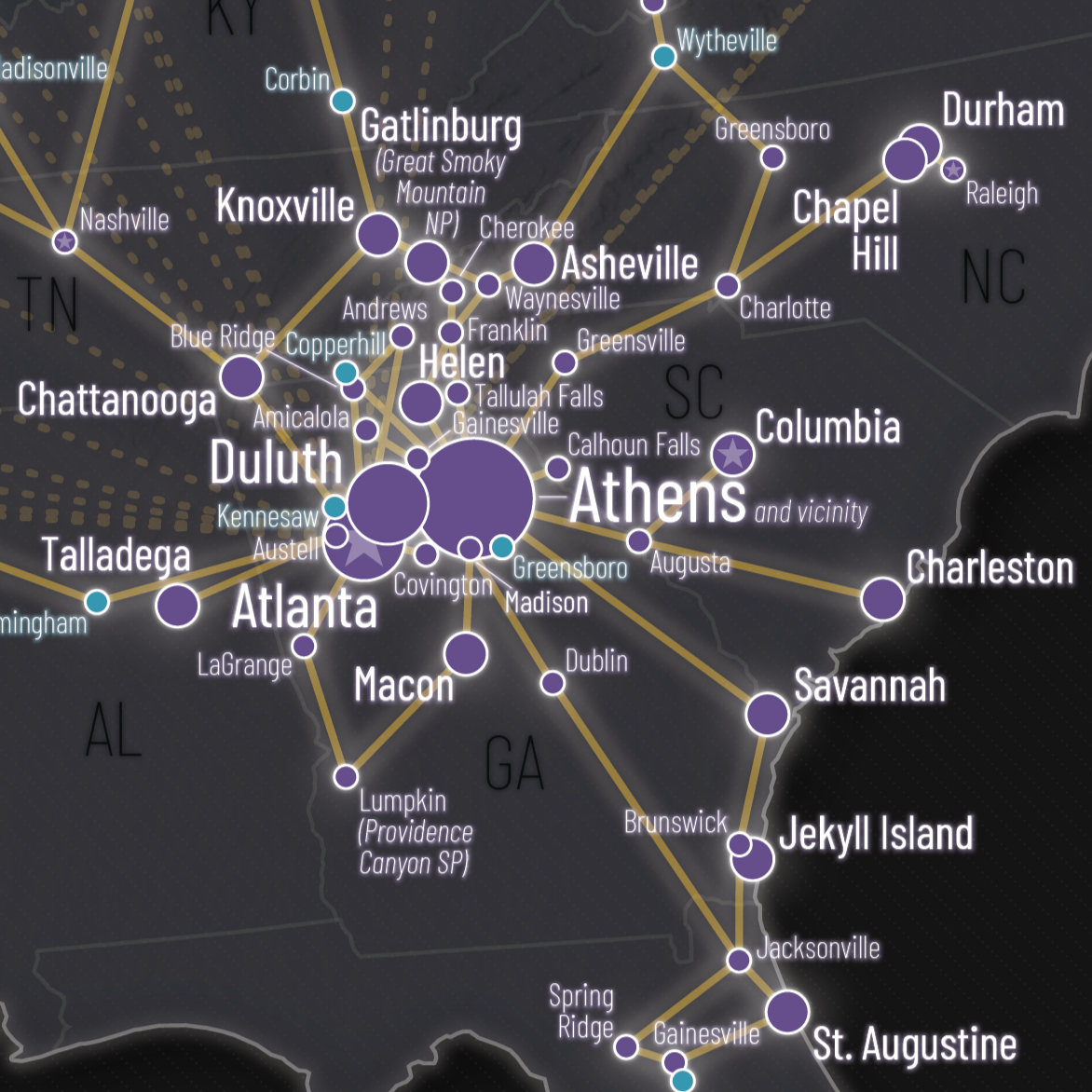
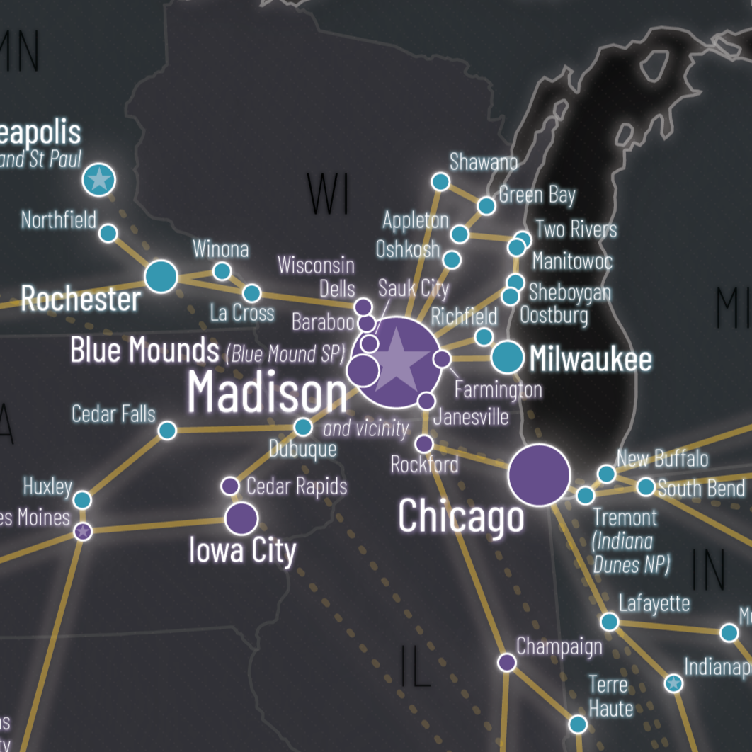
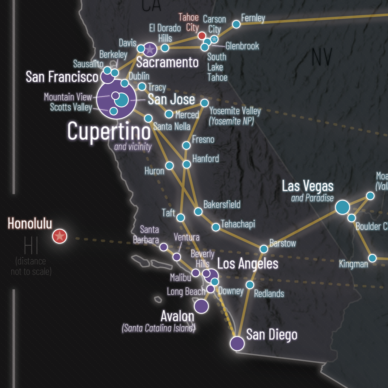
This map visualizes the footprint of me and my wife in the United States since 2015. There are several historical versions, and the latest update was in Sep 2025. An abstract network of our visited places (city center instead of real visited location) is added at different levels: resident, visited frequently, visited twice / major destination, visited once. Trips with different transportation mode are displayed using differently styled lines, and state capitals are displayed with a star symbol.
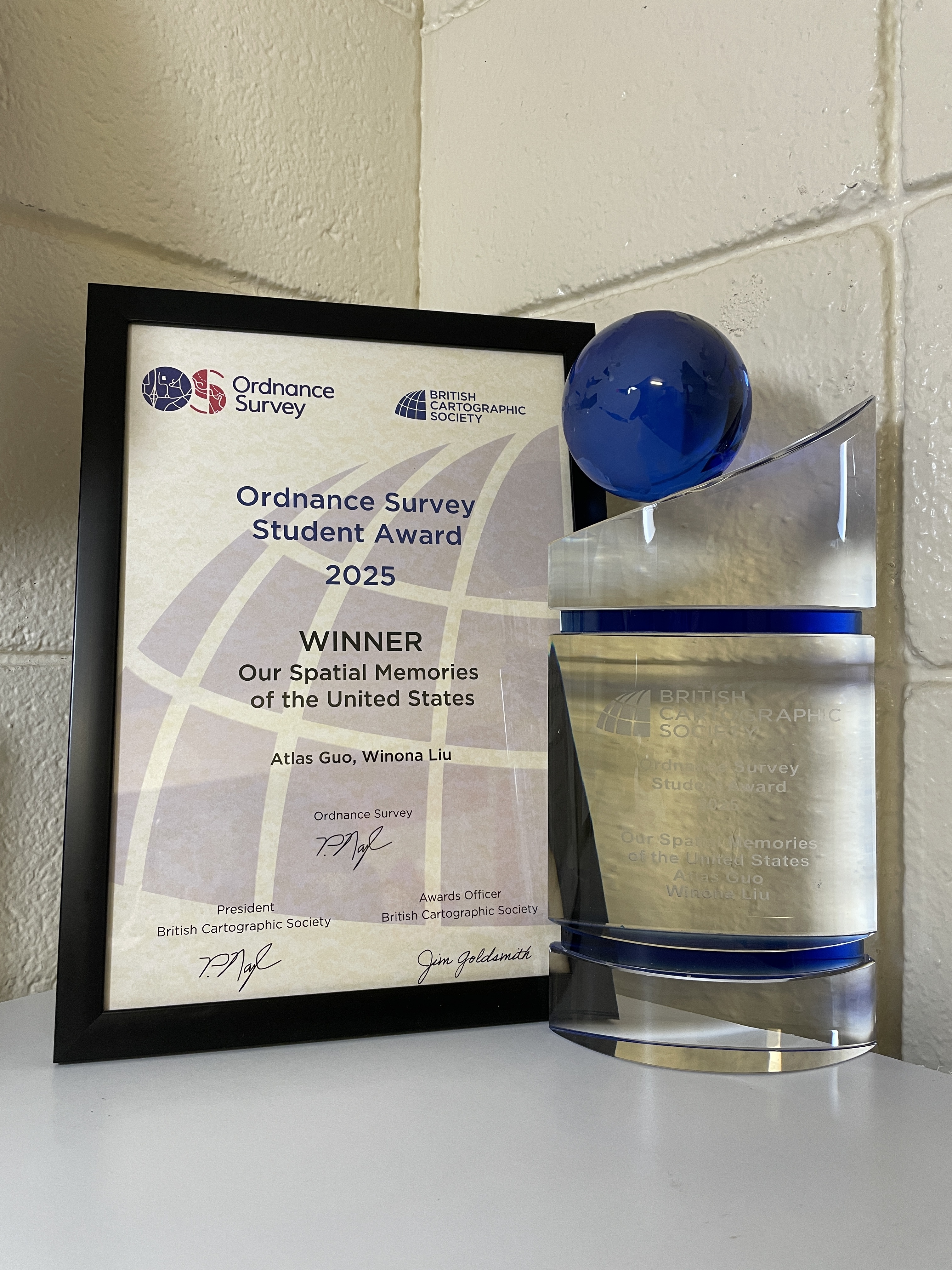
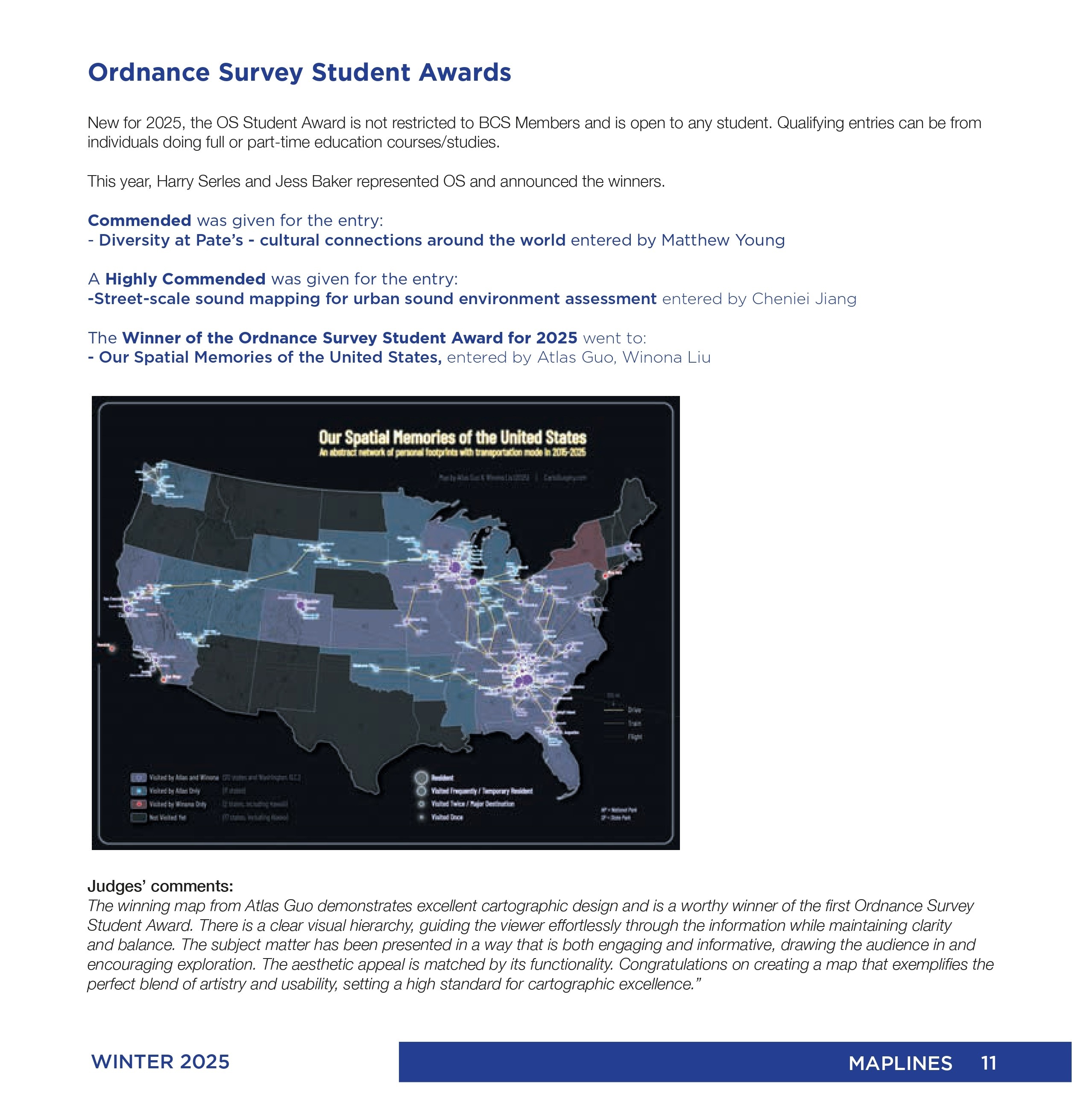
This map won the Ordnance Survey Student Award by British Cartographic Society in 2025.
This map was displayed in the map gallery (map poster) of North American Cartographic Information Society (NACIS) 2025 annual meeting at Louisiville, KY (Oct 15-17). Check out my other entries in the map gallery!
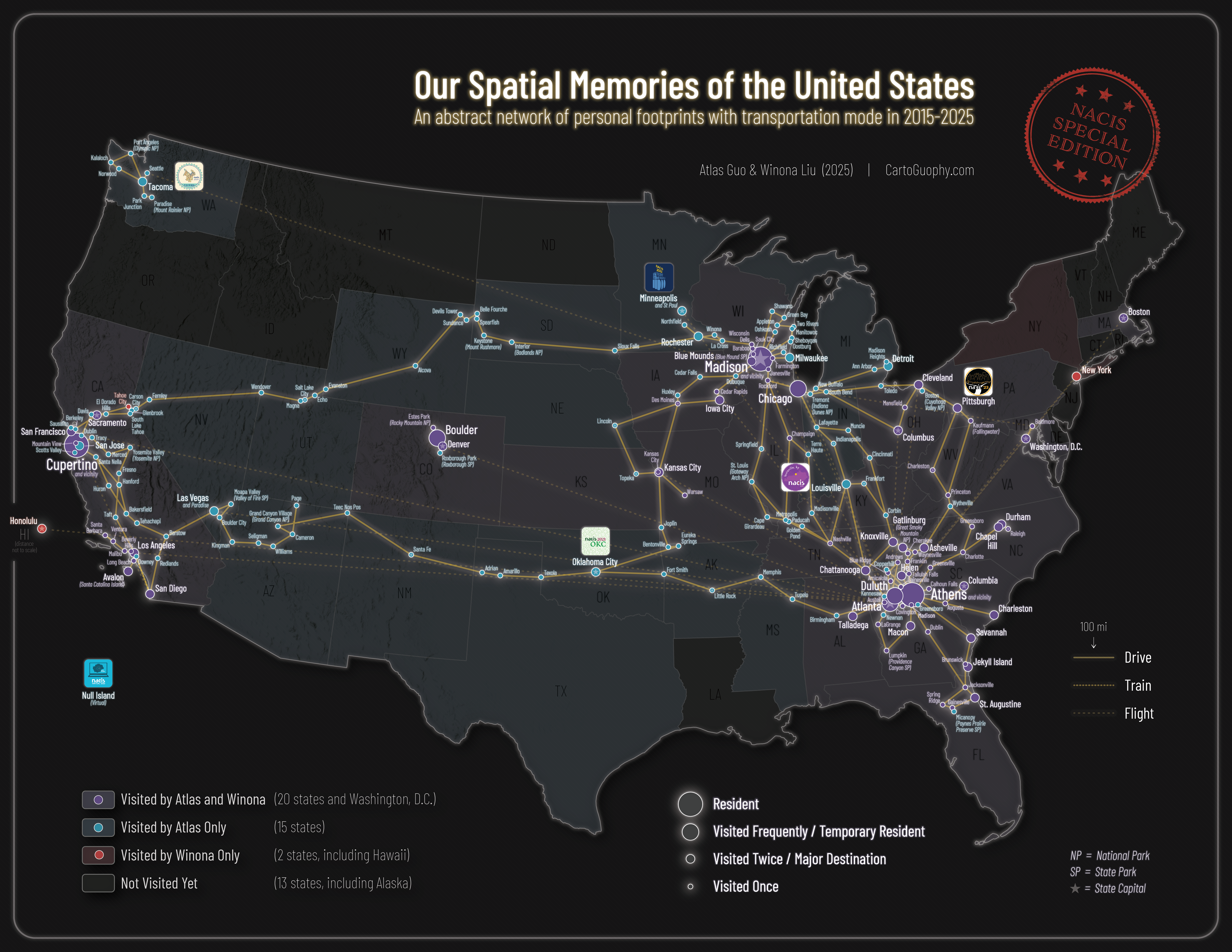
In this special edition, the logos of NACIS conferences I attended are added: Null Island / Virtual (2020), Oklahoma City (2021), Minneapolis (2022), Pittsburgh (2023), Tacoma (2024), Louisiville (2025).