Mapping BayGeo Membership in LEGO Style
A BayGeo LEGO map exploring terrain, proportional symbols, color, size, and visual hierarchy.
 Download Compressed Image
Download Full-Size Image
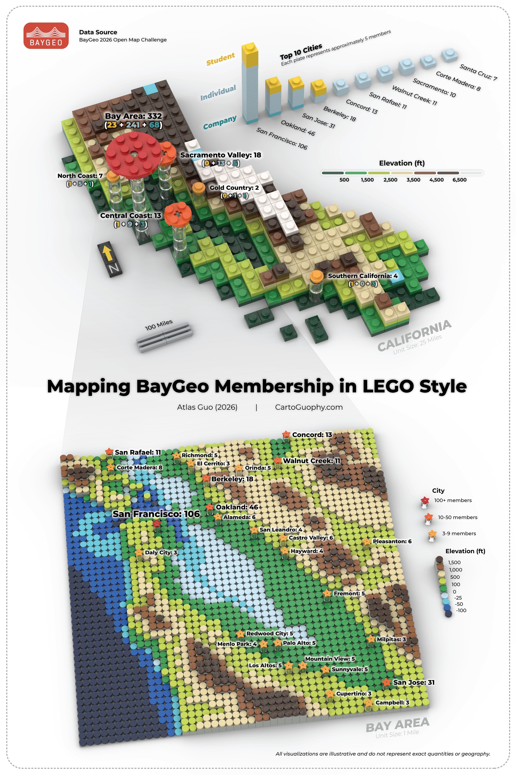
Created for BayGeo 2026 Open Map Challenge, this digital LEGO map builds on my ongoing work with topographic mapping while exploring proportional symbol visualization. The layout integrates a terrain backdrop with thematic symbols in a three-dimensional composition. Three graduated classes, distinguished by color and/or size, communicate differences in magnitude while maintaining a clear visual hierarchy and cohesive LEGO aesthetic.
Click to view more of my LEGO maps!