LEGO Mapping
LET THERE BE MAPS.
This page displays my LEGO-style maps since early 2024, spanning both physically built and virtually rendered work and gradually evolving from topographic to thematic maps, presented in chronological order of finish time.
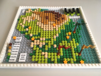
LEGO Map of
Wisconsin
Featured in Esri UC Plenary Session;
Most Unique Map, Best Student Map,
President’s Choice, People’s Choice
(Adult) in WLIA 2024 Map Contest
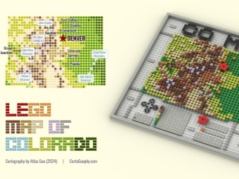
LEGO Map of
Colorado
Winner of Student
Artistic Section in
GISCO Mapping Contest;
one brick = 10 sq mi
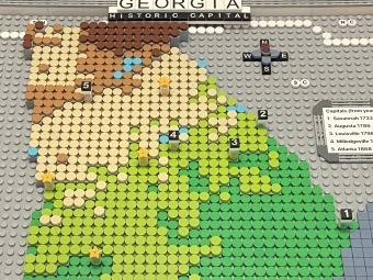
LEGO Style
Topographic
Map of Georgia
Topographic map
of Georgia with labels
(1 dot represents 8*8 sq mi)
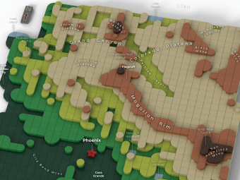
Physical Geography
of Arizona
in LEGO Style
3D rendered graphics with labels;
winner of college student project,
AGIC Symposium Maps Contest
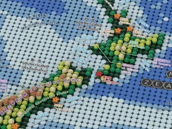
Physical Geography
of New Zealand
in LEGO Style
Displayed on Map Exhibition of
GeoCart'2024, New Zealand's
National Cartographic Conference
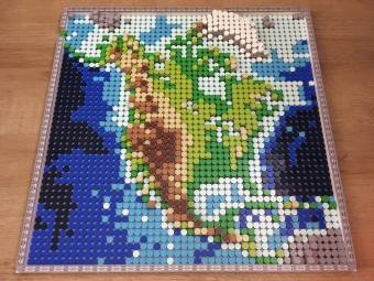
LEGO Map of
North America
Best Student Map in
WLIA 2025 Map Contest;
Collected by American
Geographical Society Library
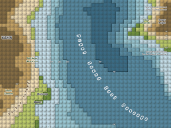
Lego Style
Map Quilt
for NACIS 2024
Contributing one
map quilt tile in
Seattle-Tacoma Area
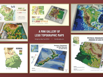
A Mini Gallery
of LEGO Style
Topographic Maps
Runner-Up of Mapping
Poster Award in WLIA
2025 Map Contest
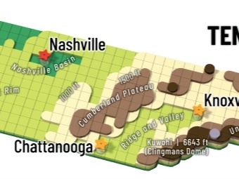
LEGO Topographic
Map of Tennessee
3D rendered LEGO graphic
using layered round tiles
with labels of physical features,
contour lines, and major cities
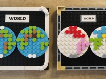
LEGO Hemisphere
World Map
Two abstract world maps
made with LEGO round tiles;
one represents topography and
one displays different continents

LEGO Cartogram
of U.S. Presidential
Election 2024
Each blue/red round plates
represent a electoral vote
for Democrats/Republican
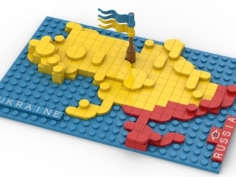
LEGO Map of
Ukraine in Conflict
Physical LEGO map in theme color
of Ukraine (blue and yellow),
with red cover showing
land invaded by Russia

3D LEGO Map of
Madison City Flag
Representing the essential
geography on Madison's
official city flag: lakes, isthmus,
capitol building with dome
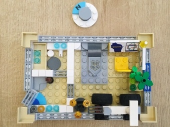
LEGO Micromapping
of Room Layout
Abstract and fun 3D
representation of apartment
room layout using
LEGO elements
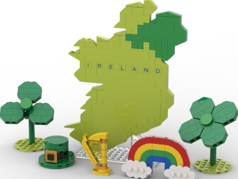
Mini LEGO Map
of Ireland
Coastal cliffs and rolling hills
transformed into layered brick
elevations across the island
in compact scale rendering
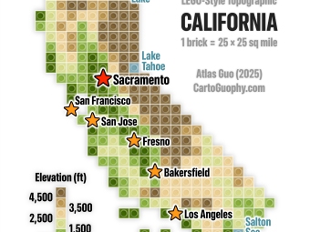
LEGO Style
Topographic Map
of California
Pixelated topographic map
with each brick representing
25*25 square miles
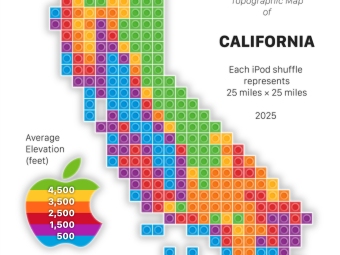
Apple-Themed
Topographic Map
of California
Featuring rainbow Apple logo
and iPod shuffle music player
as a creative salute to Apple

LEGO Apple
Maps Icon
iOS design icon reinterpreted in
LEGO as creative homage to
Apple's mapping platform and
its visual design language
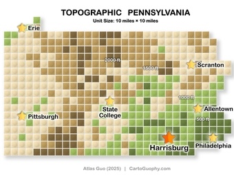
LEGO Map of
Pennsylvania
Topography expressed through
colorful brick elevation steps
capturing mountain ranges and
valleys across the Keystone State
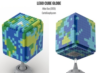
LEGO Cube
Globe
Curved LEGO tile assembly
presents global geography from
spherical perspective showing all
continents in one visualization

LEGO Atlanta Metro
(MARTA) Map
Schematic showing four colored
subway routes and I-285 beltway
converging to illustrate Atlanta's
transit network in LEGO form
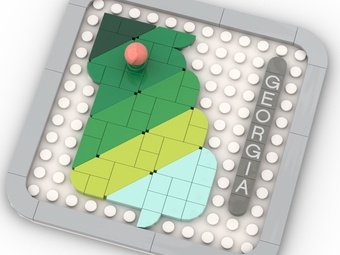
Mini LEGO Map
of Georgia
State topography compressed at
miniature scale from mountain
peaks to coastal plain and relief
features of the Peach State
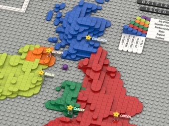
LEGO Map of the
UK and Ireland
Four UK nations and Irish
Republic distinguished through
distinct brick patterns showing
political and geographic divisions
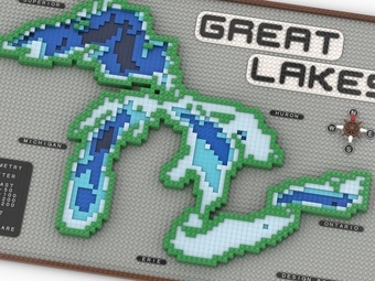
LEGO Bathymetric
Map of the
Great Lakes
Inland seas rendered with blue
depths and surrounding landforms
showing bathymetry
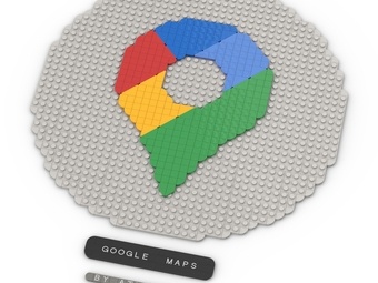
LEGO Google
Maps Icon
Digital interface reinterpreted
with brick textures, roads, and
labels as playful homage to
mapping interface design
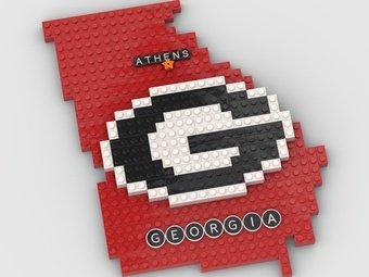
LEGO Georgia Map
with UGA Logo
Topography combined with UGA's
iconic Bulldog emblem expressing
proud connection between campus
and state geography
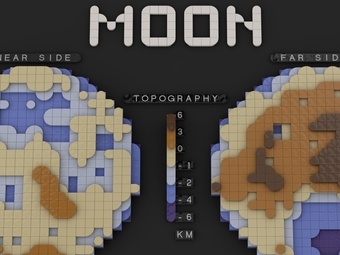
LEGO Moon
Map
Lunar topography revealed through
grayscale brick relief showing
maria, highlands, and impact
craters of the lunar surface
LEGO Map of
Lawrenceville
Street-scale mapping in LEGO
capturing neighborhood character
through parcels and pathways of
Pittsburgh's historic district
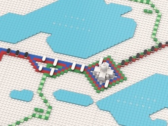
LEGO Madison
BRT Map
Transit routes and stations
mapped with LEGO visualization
revealing expansion plans and
future growth of the system
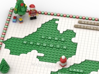
LEGO Christmas-
Themed Map of
Madison
Festive winter wonderland with
holiday lights, snow, and cheer
through seasonal LEGO palette
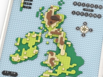
LEGO Topographic
Map of the
British Isles
Terrain from Scottish peaks to
English lowlands expressed
through different heights

LEGO 2026
New Year Map
Annual celebration with modern
aesthetic rendered in colorful
bricks expressing optimism and
hopes for the year ahead
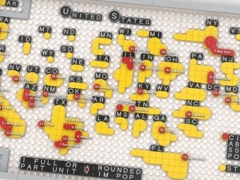
Gridded Cartogram
of U.S. Population
Each full or partial unit
represents one million people
based on estimated 2025
state population
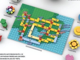
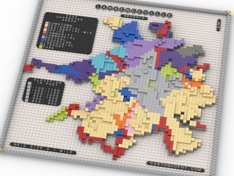
Pokémon Kanto
Region Map
LEGO-style tribute to
Pokémon's 30th anniversary
inspired by the classic
Kanto Region (Red and Green)
Framed LEGO Icon
of Wisconsin Land
Information
Association
Tribute to WLIA
featuring
a folded Wisconsin map
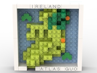
LEGO Ireland Map
in Theme of
St. Patrick's Day
Vertical mosaic celebrating
Irish geography, culture,
and St. Patrick's Day
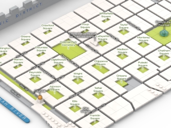
LEGO Map of
Savannah Historic
District
Tribute to Savannah's
ward-and-square urban form
through LEGO structure
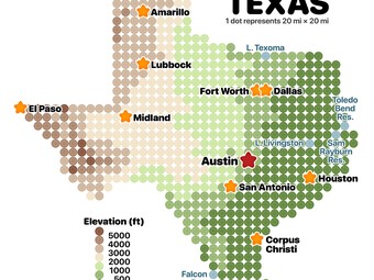
LEGO Topographic
Map of Texas
Brick-built terrain
representation
translating
Texas landforms into
layered LEGO topography