LEGO Maps of Contiguous U.S.
A paired LEGO study of the contiguous U.S., combining territorial history with a local topographic view.
 Download Compressed Image
Download Full-Size Image
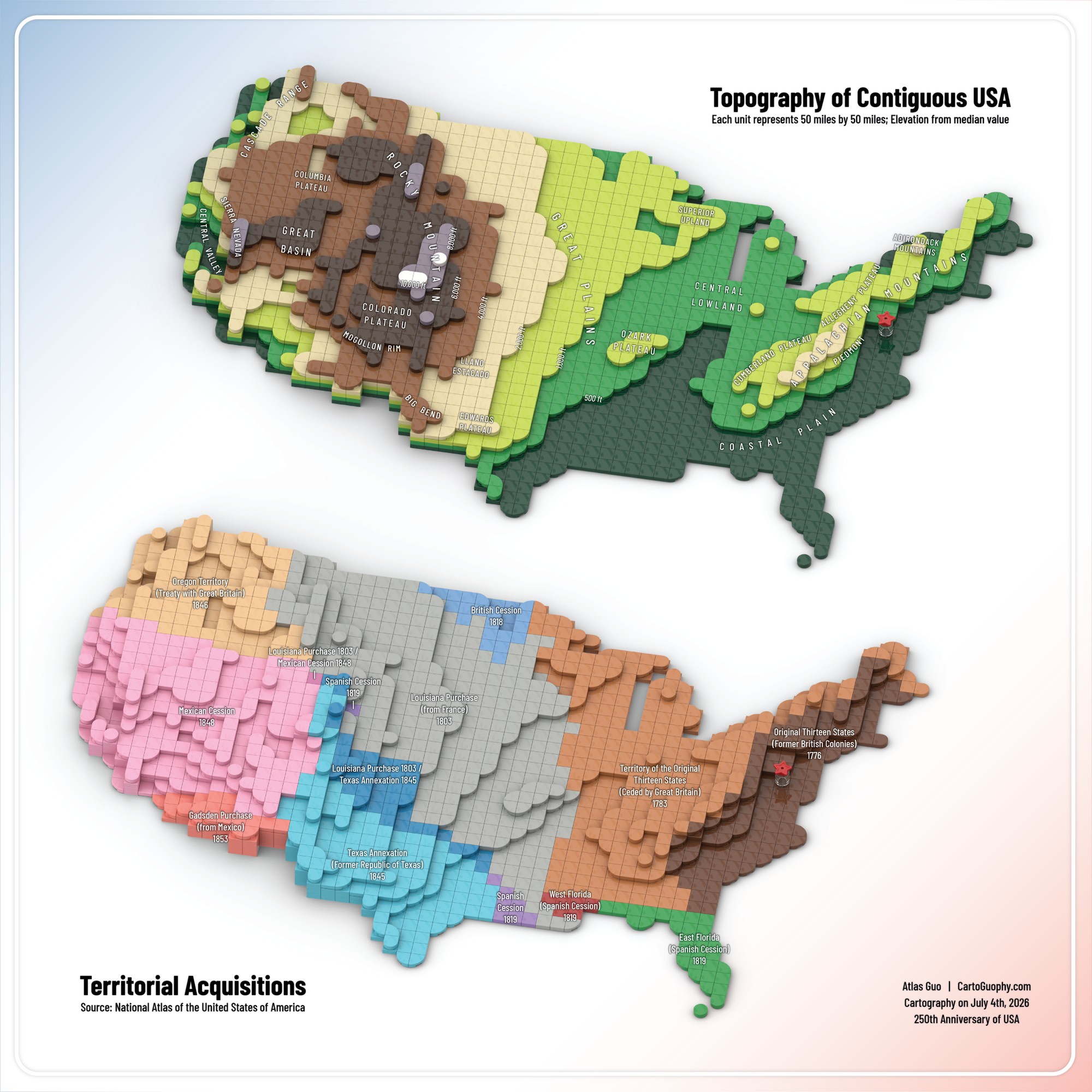
Created to celebrate the United States' 250th anniversary on July 4, 2026, these two LEGO-style maps offer innovative views of the contiguous United States: one depicting topography, the other tracing territorial acquisitions. Each unit represents 50 x 50 miles. Their shared grid and geographic extent provide a consistent framework for exploring the country's physical landscape and territorial history through the visual language of LEGO.
The second image shows a localized version of the topographic map.
Click to view more of my LEGO maps!