LEGO Topographic Map of Missouri
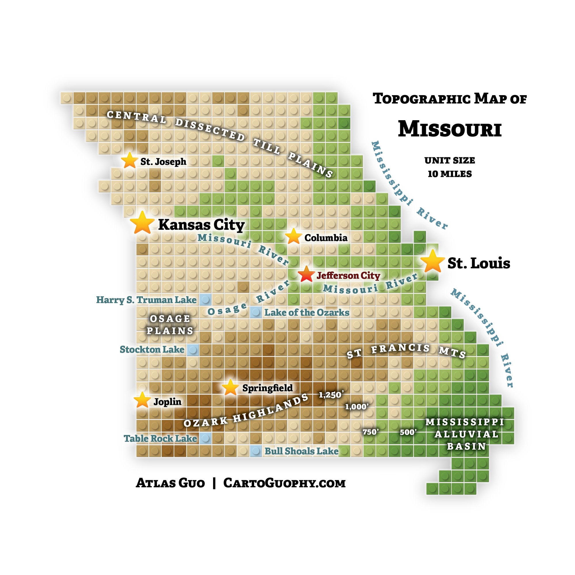
A LEGO map of Missouri's terrain, from state capital to major and smaller cities across varied landscapes.
 Download Compressed Image
Download Full-Size Image
This LEGO topographic map represents Missouri with one unit corresponding to 10 miles. Different colors and elevations distinguish major physiographic regions, including the Central Dissected Till Plains, Osage Plains, Ozark Highlands, St. Francois Mountains, and Mississippi Alluvial Basin. The map highlights the state capital, Jefferson City, followed by the major cities of St. Louis and Kansas City, as well as smaller cities including Columbia, Springfield, Joplin, and St. Joseph. Major rivers and lakes are also labeled throughout the map.
Click to view more of my LEGO maps!