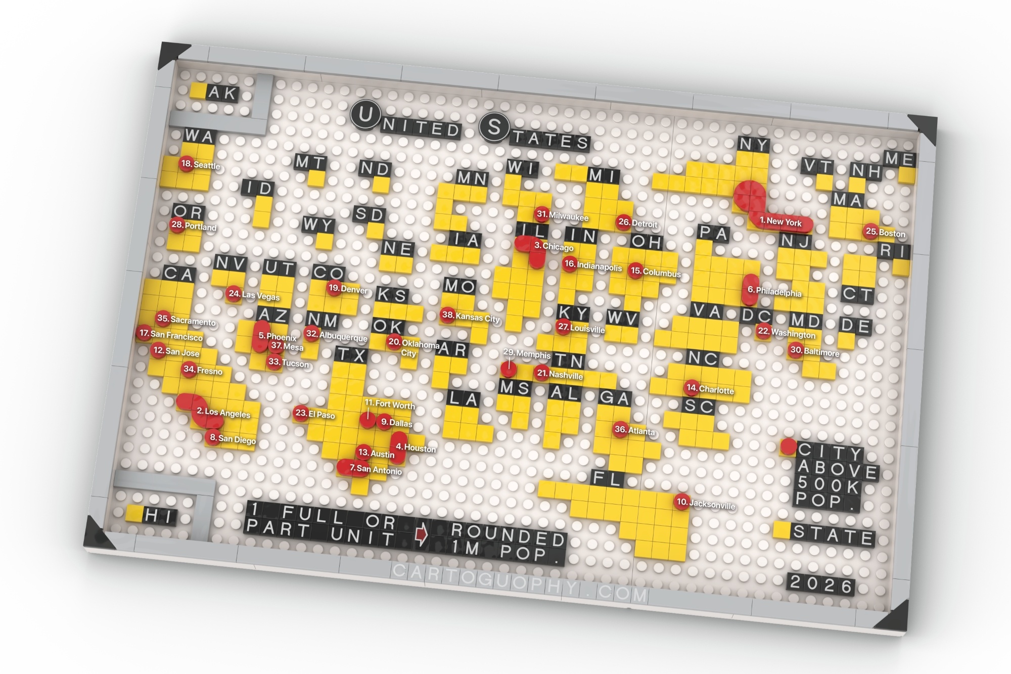
Gridded Cartogram of U.S Population
Each full or partial unit represents 1 million population (rounded)
 Download Compressed Image
Download Full-Size Image
 Download Compressed Image
Download Full-Size Image
Sharing a recent byproduct from research: a rounded, one-million-population gridded cartogram based on estimated 2025 population for each U.S. state, totaling 342 units. It’s really challenging to maintain recognizable state geometry while keeping adjacencies reasonably accurate. After translating it into LEGO form, I also added cities in one-million increments (those below 500K are not included). Here are two design styles (square vs. round): which one do you prefer?