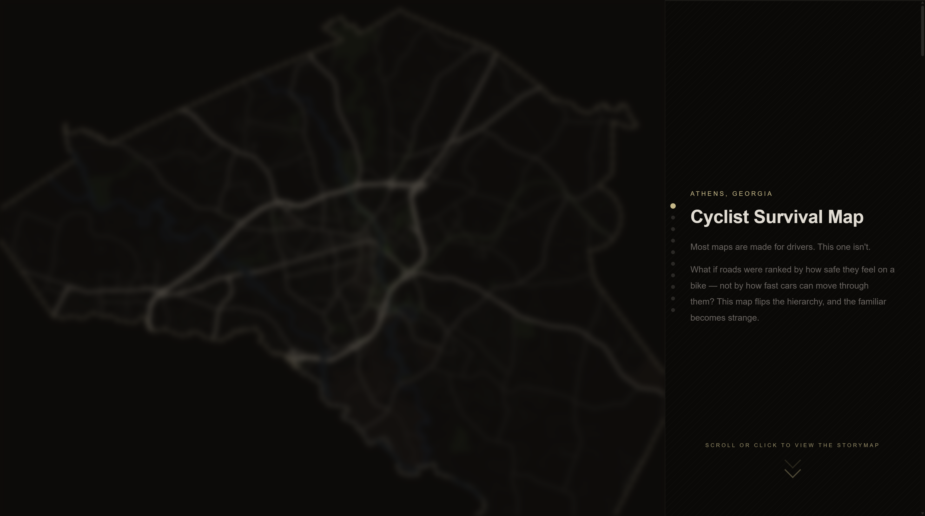
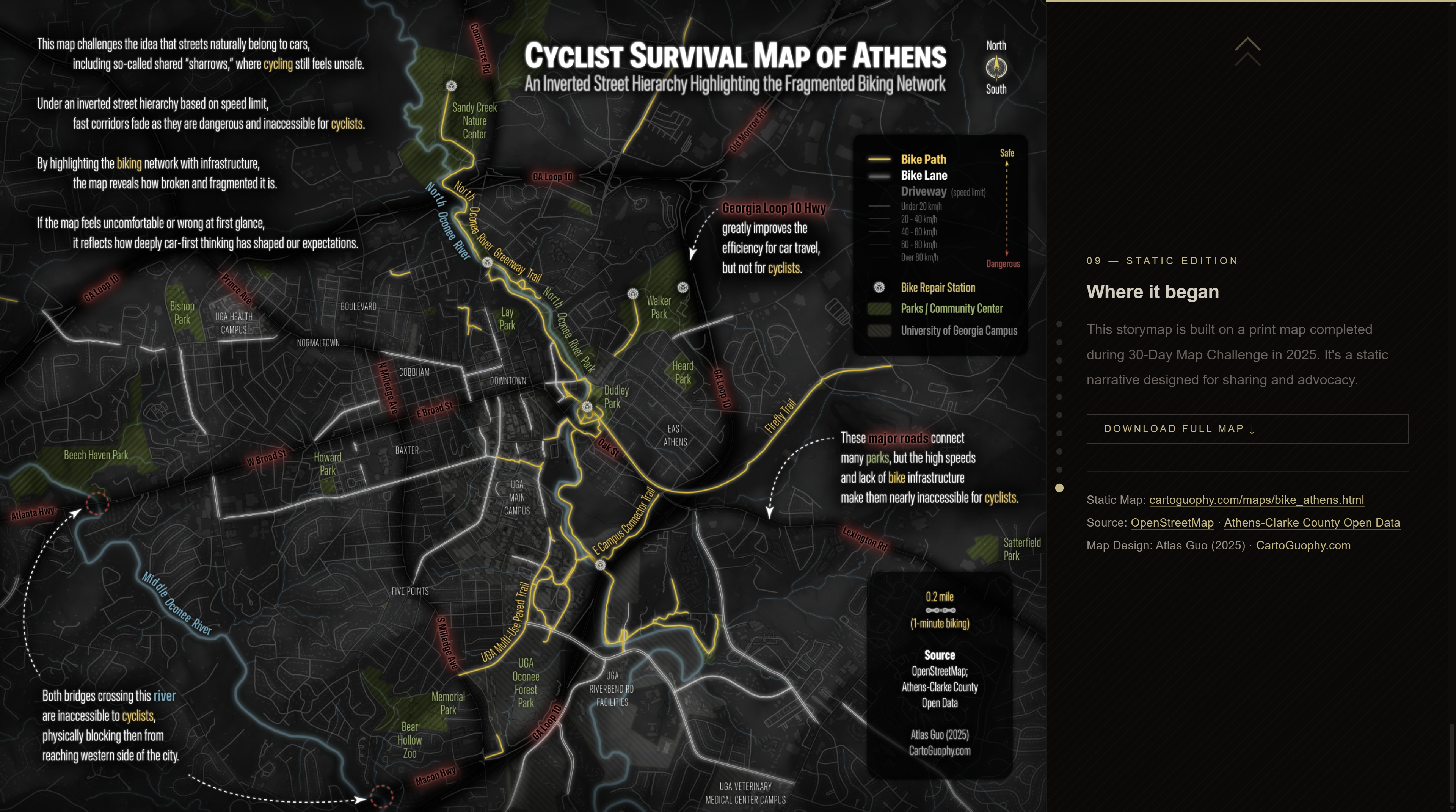
Cyclist Survival Map of Athens (Georgia)
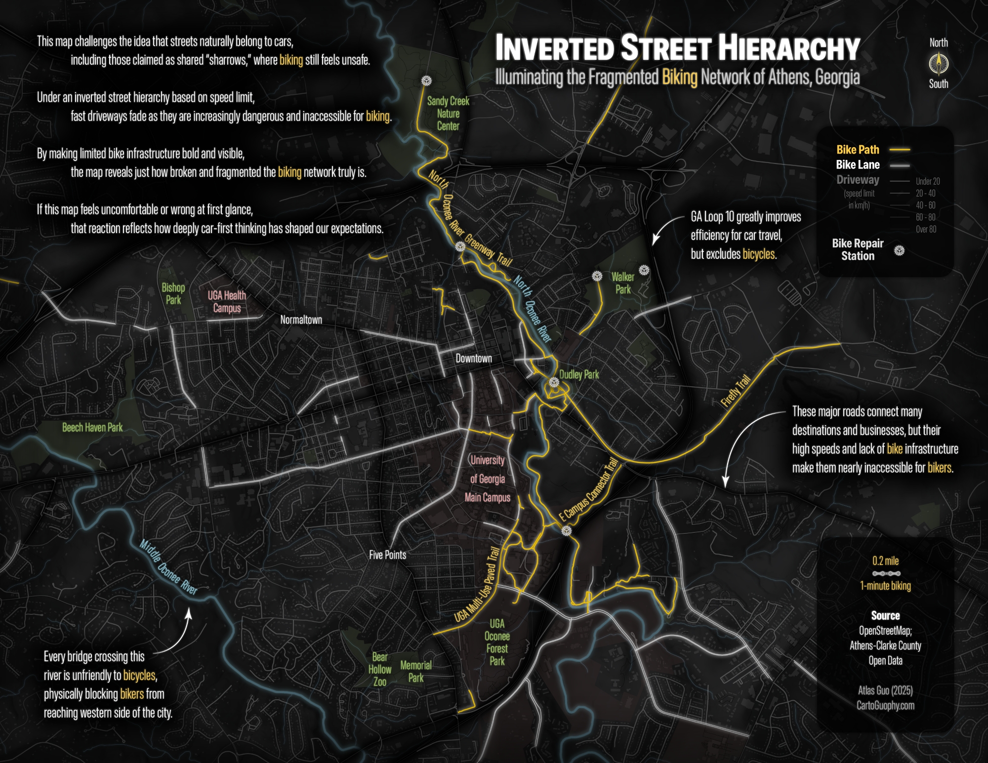
Inverted Street Hierarchy Illuminating the Fragmented Biking Network of Athens, Georgia
 Download Compressed Image
Download Full-Size Image
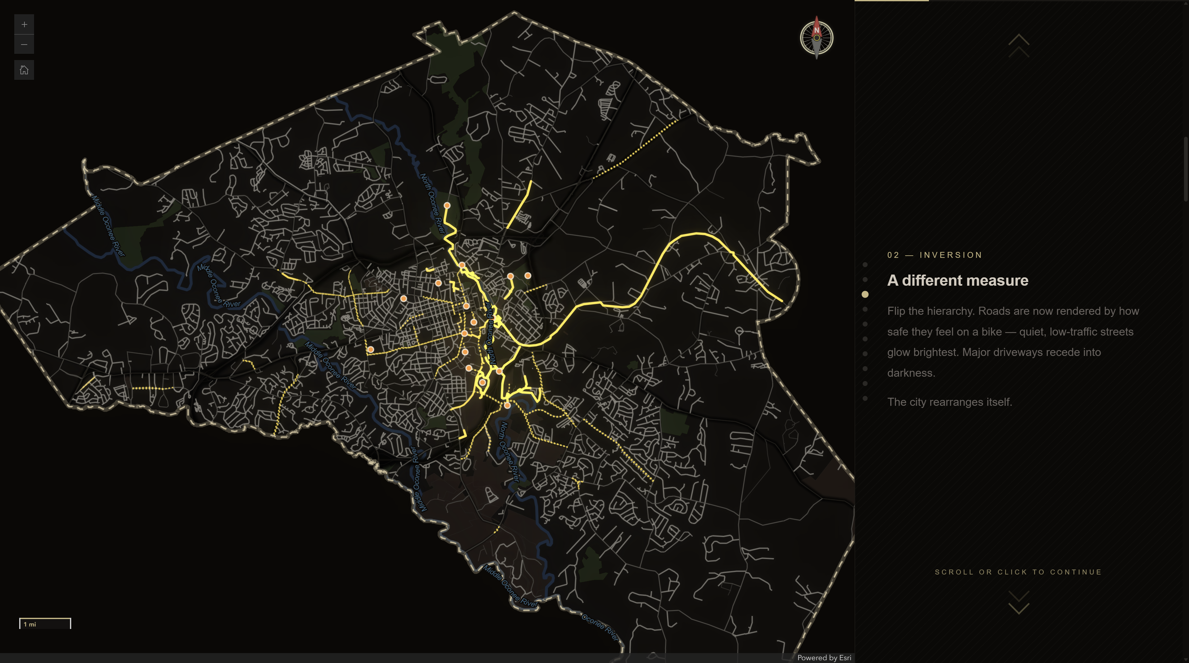
This map challenges the idea that streets naturally belong to cars, including so-called shared
“sharrows,” where cycling still feels unsafe. Under an inverted street hierarchy based on speed
limit, fast corridors fade as they are dangerous and inaccessible for cyclists. By highlighting the
biking network with infrastructure, the map reveals how broken and fragmented it is. If the map feels
uncomfortable or wrong at first glance, it reflects how deeply car-first thinking has shaped our
expectations.
Source: OpenStreetMap,
Athens-Clarke County Open Data
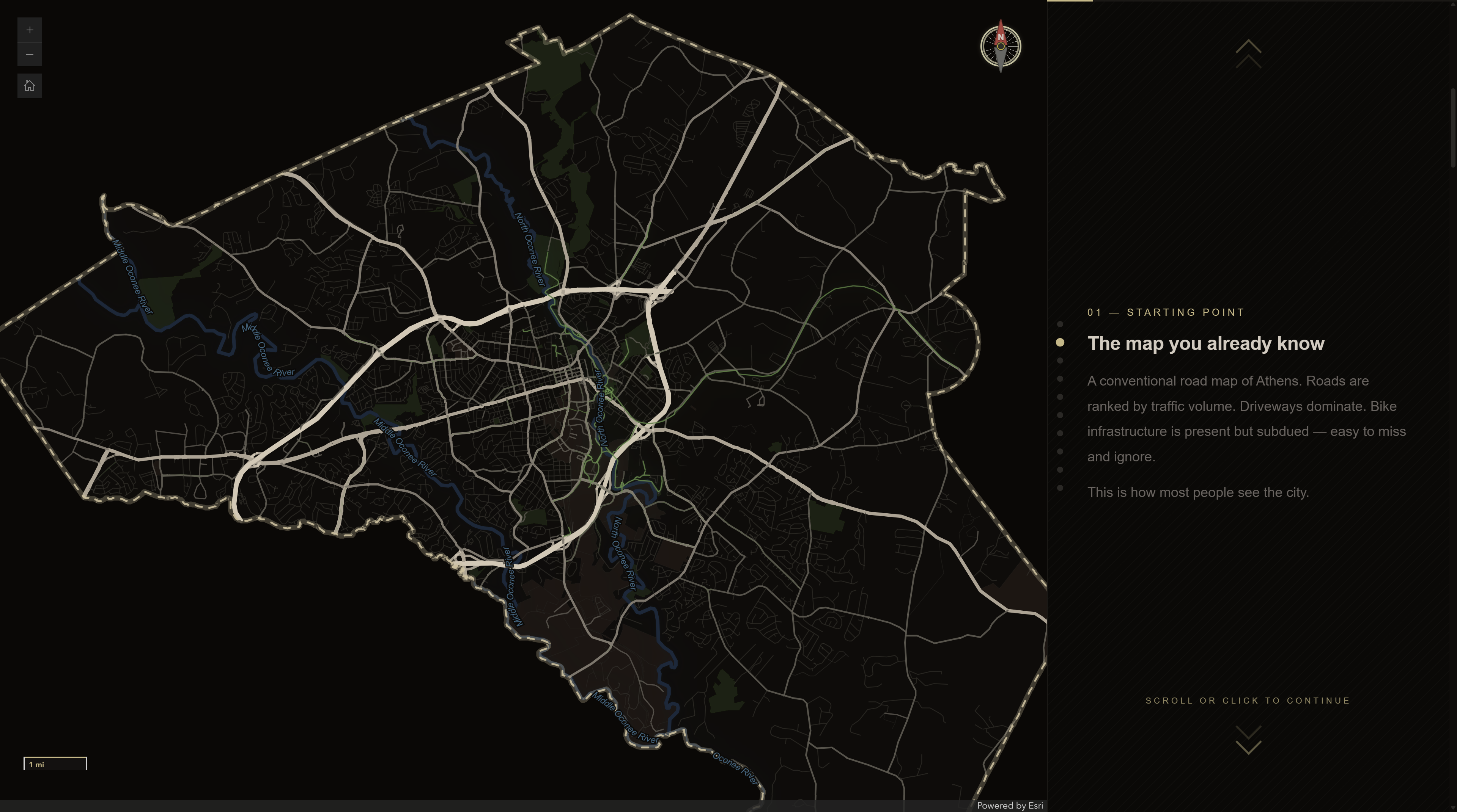
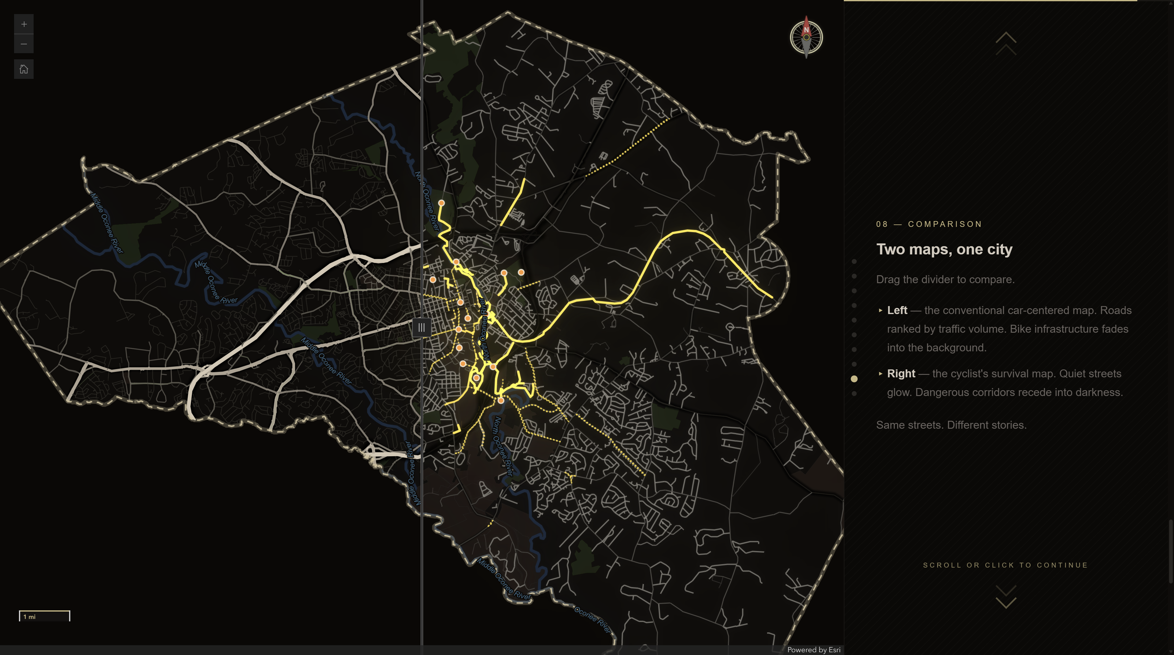
For a recently built interative version (storymap-style narrative), please visit http://cartoguophy.com/bike-athens/
(desktop viewing only). Some screenshots are shown below.
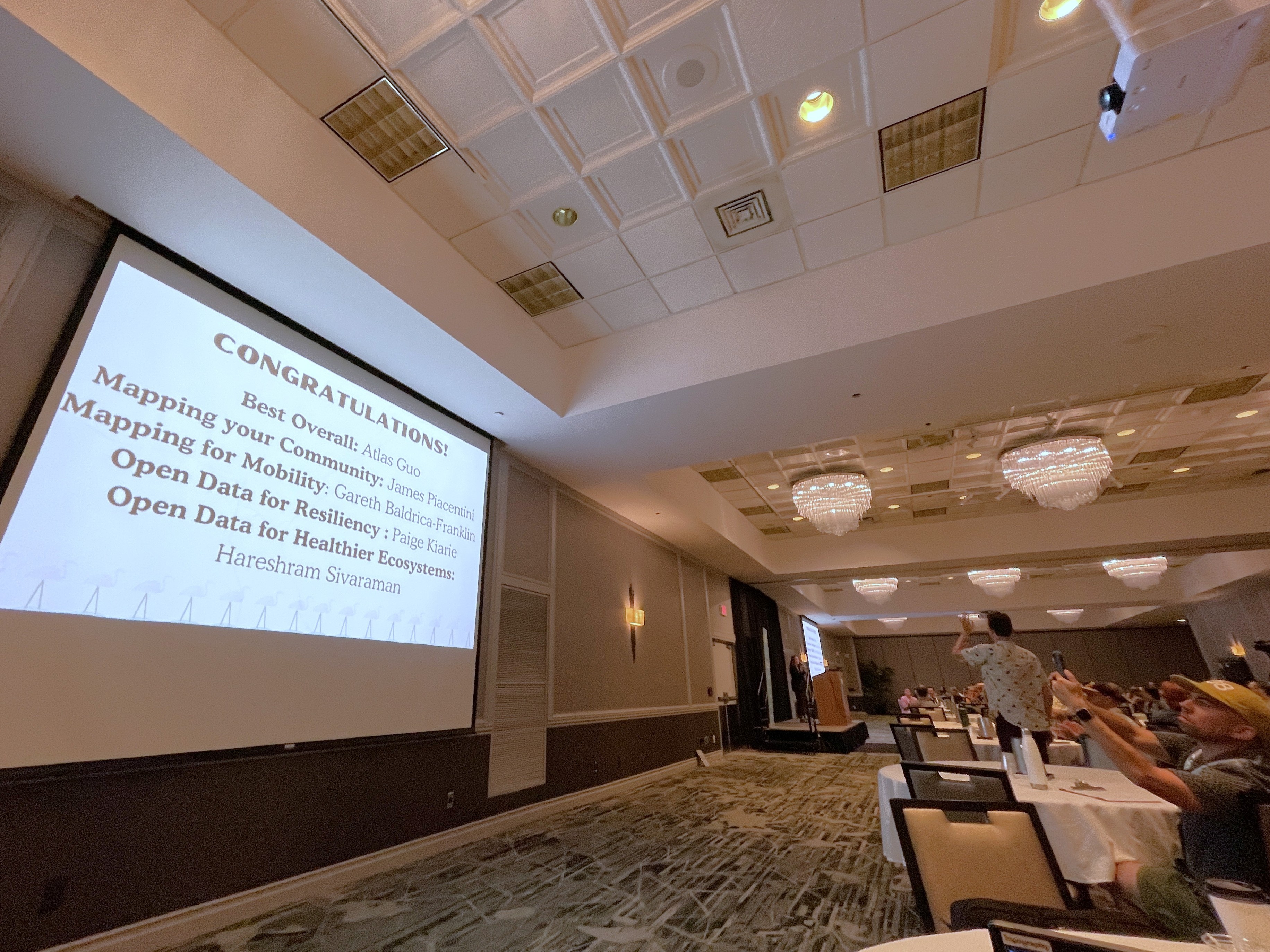
This storymap won the Best Overall Map Award in State of the Map US 2026 Narrative Map Competition (OpenStreetMap US and Esri).