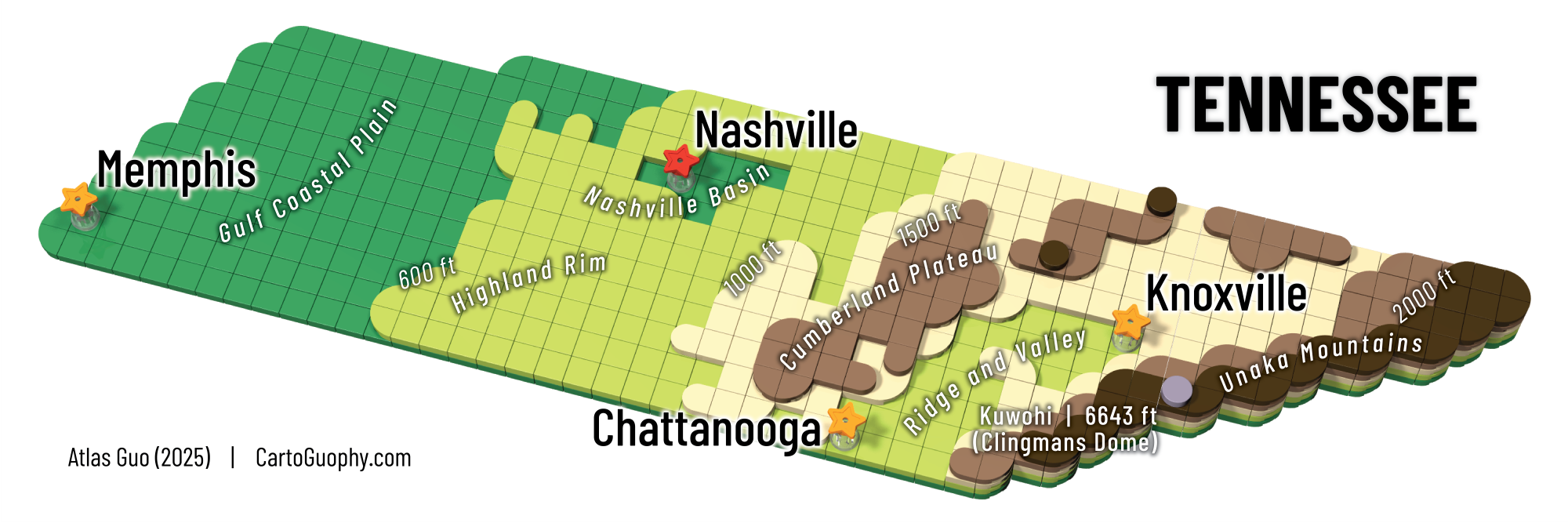
LEGO Topographic Map of Tennessee
3D rendered LEGO graphic using layered round tiles with labels of physical features, contour lines, and major cities
 Download Compressed Image
Download Full-Size Image
This is a fun/educational LEGO Topographic Map of Tennessee. The terrain is represented at five levels in elevation (plus a peak), with differently raised layers and tiles in classic topographic color scheme. On top of the terrain, a major city layer is added using star symbols. In this map, each 1*1 LEGO unit represents 10*10 square miles horizontally, while labels of major cities, geophysical regions and simplified contour lines are added. In terms of cartographic design, this map is styled similarly as my immensely popular Arizona LEGO map.
Click to view more of my LEGO-Style maps !