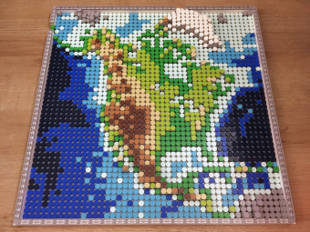
LEGO Map of
North America
Best Student Map in
WLIA 2025 Map Contest;
Collected by American
Geographical Society Library
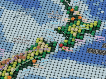
Physical Geography
of New Zealand
in LEGO Style
Displayed on Map Exhibition of
GeoCart'2024, New Zealand's
National Cartographic Conference
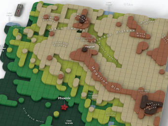
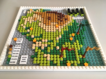
Physical Geography
of Arizona
in LEGO Style
3D rendered graphics with labels;
winner of college student project,
AGIC Symposium Maps Contest
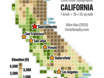
LEGO Style
Topographic Map
of California
Pixelated topographic map
with each brick representing
25*25 square miles
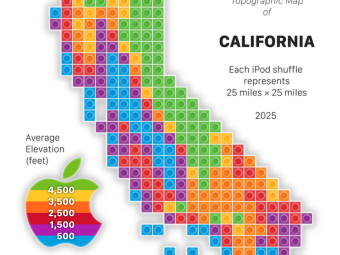
Apple-Themed
Topographic Map
of California
Featuring rainbow Apple logo
and iPod shuffle music player
as a creative salute to Apple
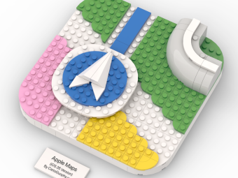
LEGO Apple
Maps Icon
A tiny map near Apple Park,
Cupertino, California;
A creative salute to
Apple Maps

LEGO Topographic
Map of Tennessee
3D rendered LEGO graphic
using layered round tiles
with labels of physical features,
contour lines, and major cities
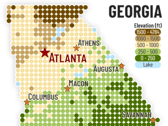
LEGO Style
Topographic
Map of Georgia
Minimalism topographic
map of Georgia with labels
(one dot represents 8*8 sq mi)
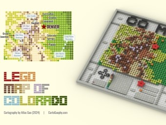
LEGO Map of
Colorado
Winner of Student
Artistic Section in
GISCO Mapping Contest;
one brick = 10 sq mi
LEGO Map of
Wisconsin
Featured in Esri UC Plenary Session;
Most Unique Map, Best Student Map,
President’s Choice, People’s Choice
(Adult) in WLIA 2024 Map Contest
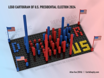
LEGO Cartogram
of U.S. Presidential
Election 2024
Each blue/red round plates
represent a electoral vote
for Democrats/Republican

LEGO Map of
Ukraine in Conflict
Physical LEGO map in theme color
of Ukraine (blue and yellow),
with red cover showing
land invaded by Russia

3D LEGO Map of
Madison City Flag
Representing the essential
geography on Madison's
official city flag: lakes, isthmus,
capitol building with dome
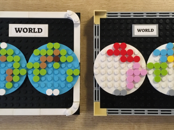
LEGO Hemisphere
World Map
Two abstract world maps
made with LEGO round tiles;
one represents topography and
one displays different continents
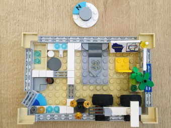
LEGO Micromapping
of Room Layout
Abstract and fun 3D
representation of apartment
room layout using
LEGO elements

Lego Style
Map Quilt
for NACIS 2024
Contributing one
map quilt tile in
Seattle-Tacoma Area
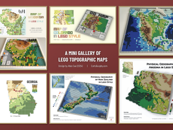
A Mini Gallery
of LEGO Style
Topographic Maps
Runner-Up of Mapping
Poster Award in WLIA
2025 Map Contest