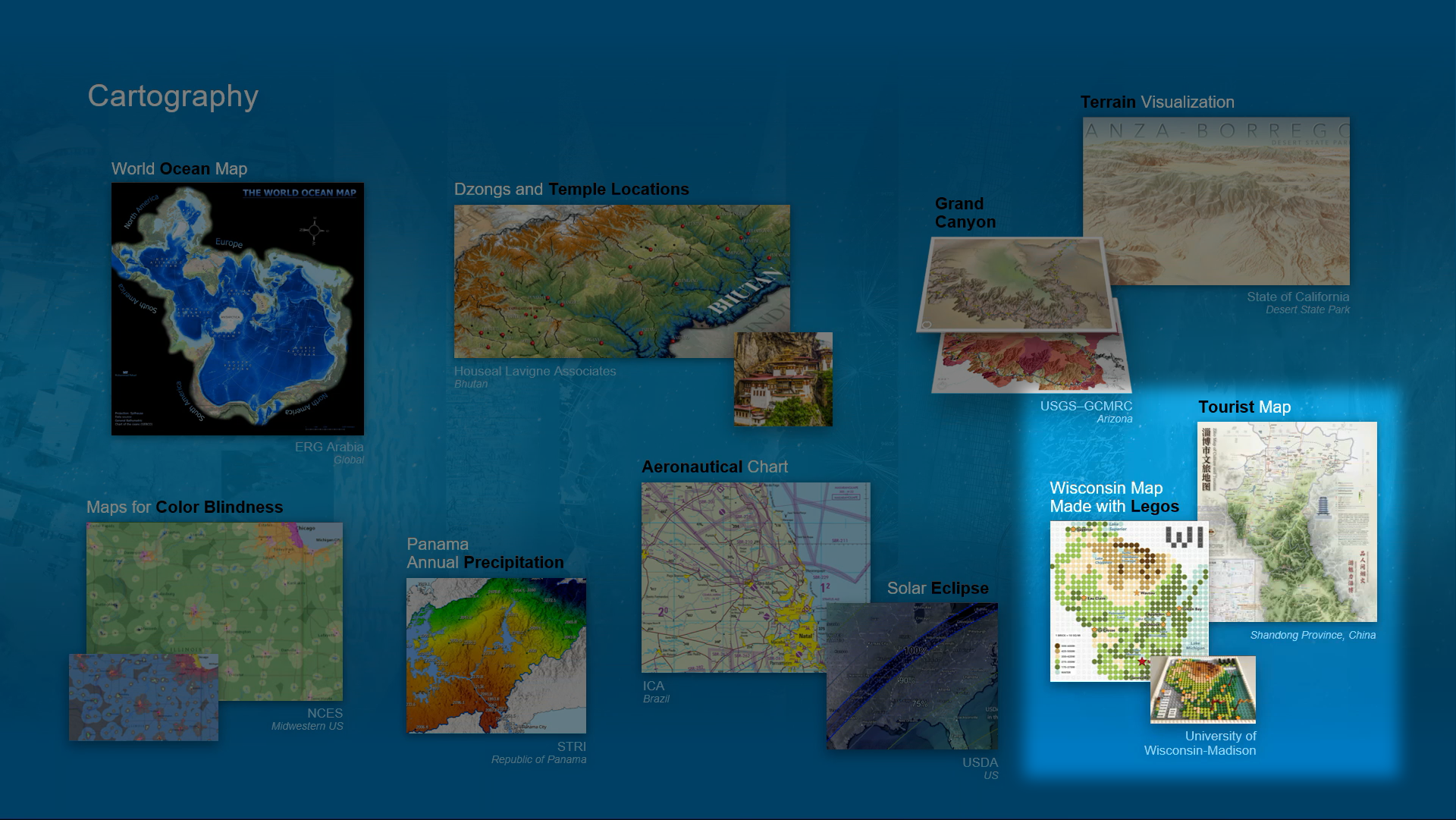
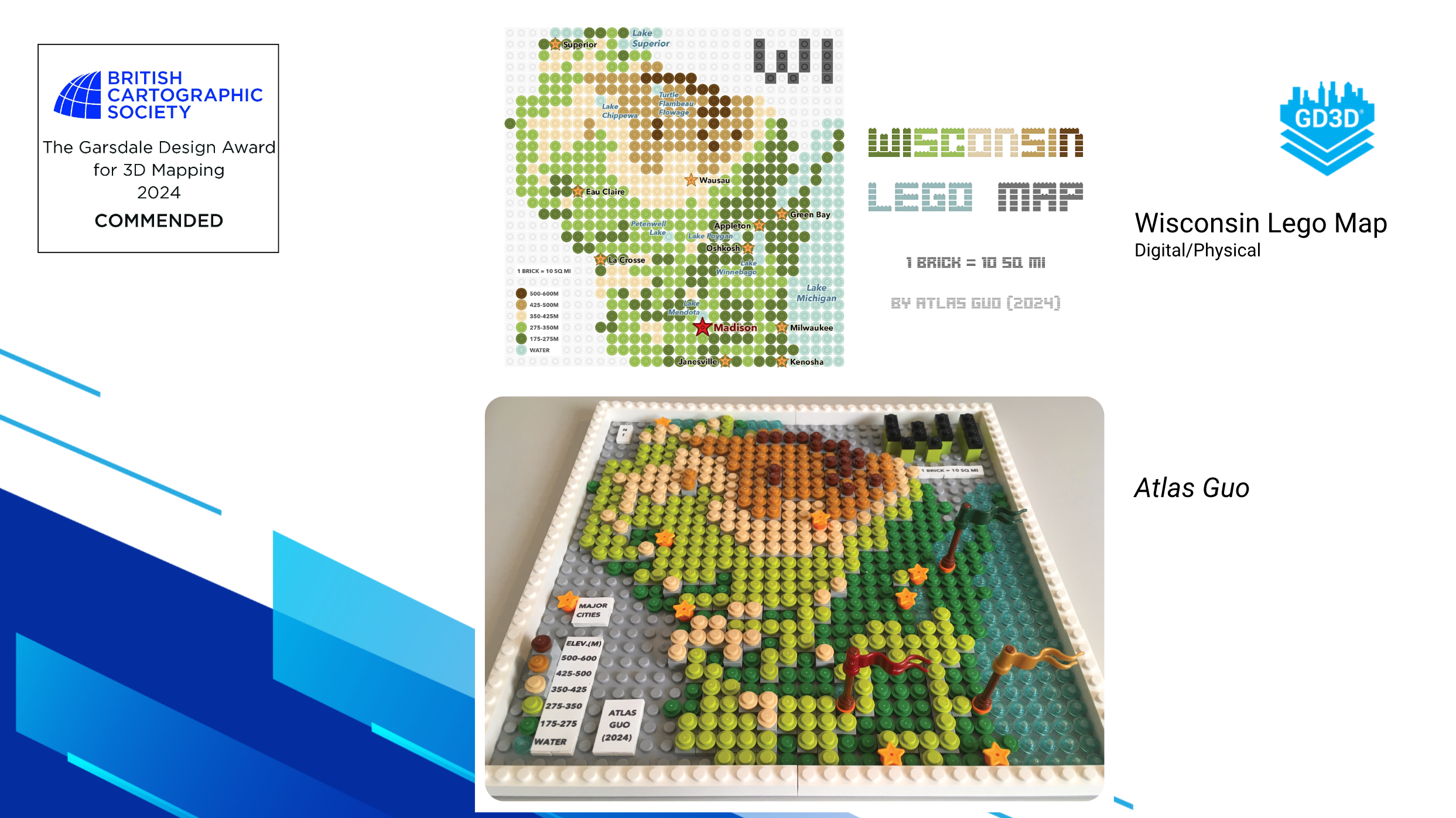
LEGO Map of Wisconsin
Featured in Esri UC Plenary Session; Most Unique Map, Best Student Map, President’s Choice, People’s Choice (Adult) in WLIA 2024 Map Contest
 Download Compressed Image
Download Full-Size Image
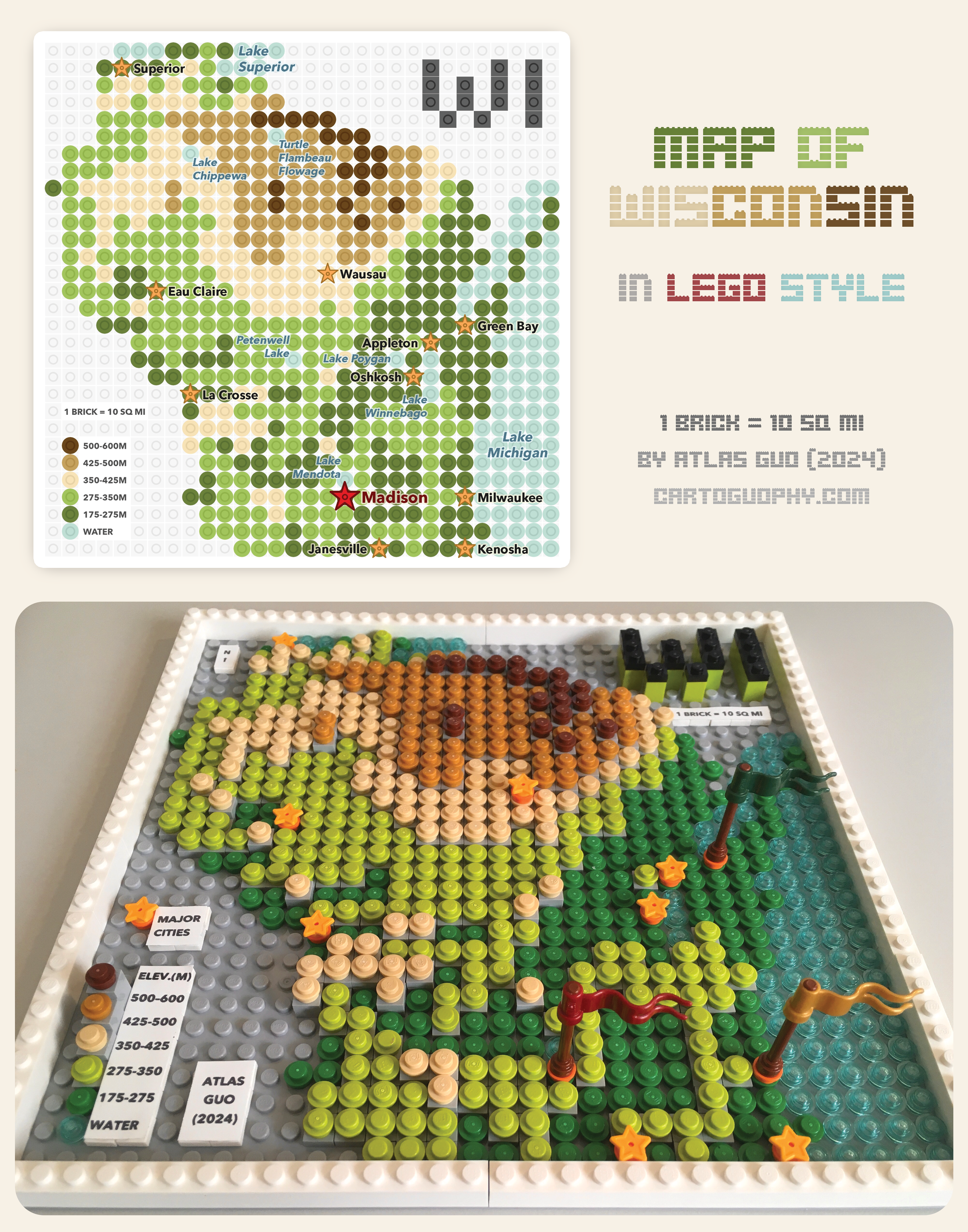
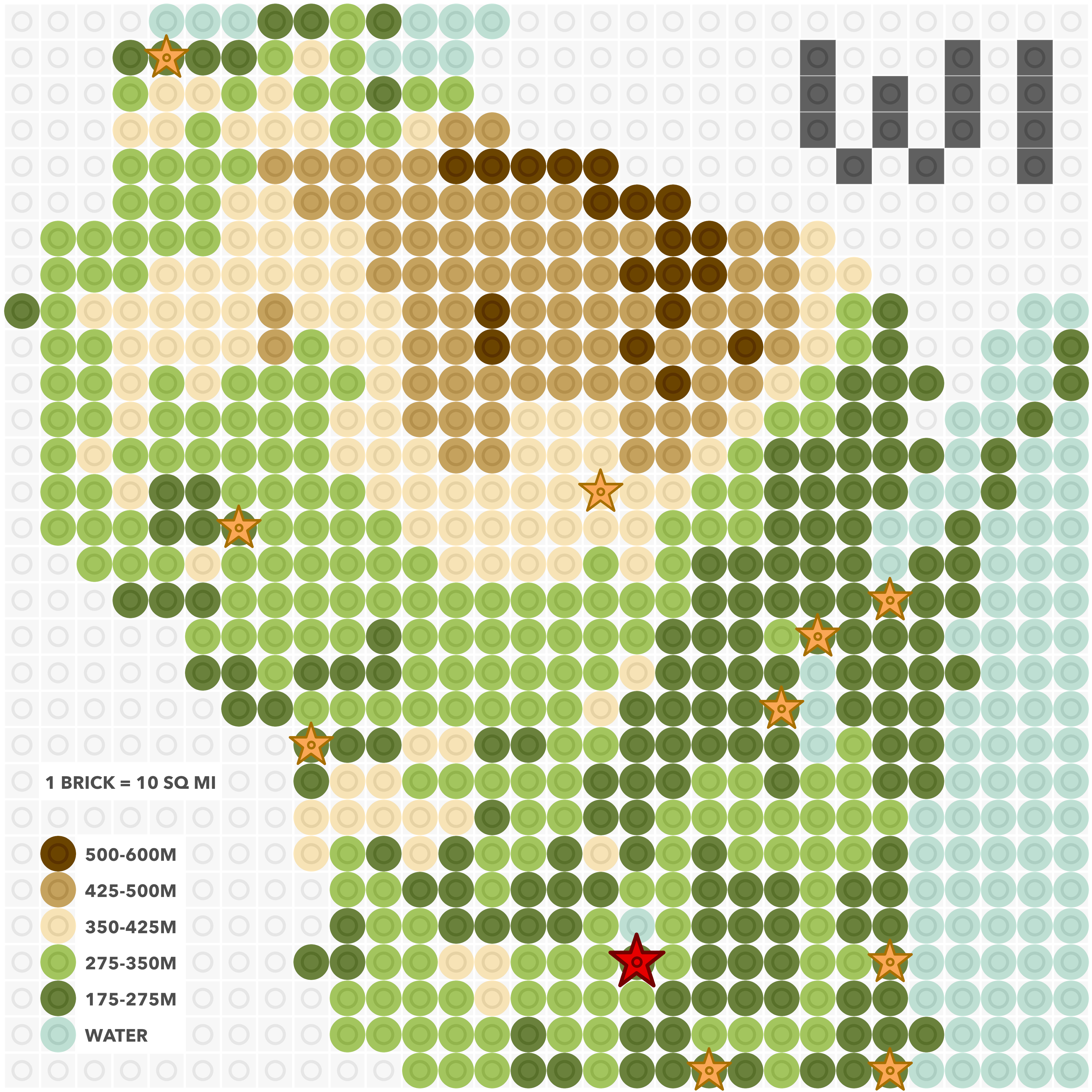
This is a fun map of Wisconsin using LEGO bricks. On this 32*32 base board, each 1*1 brick represents
10*10 square miles in reality. The terrain is physically represented at five
different levels in elevation, which has different base heights and different color bricks at top: dark
green, light green, cream/beige, light brown, dark brown. Transparent blue
bricks are used to represent major lakes in and around Wisconsin. On top of the terrain layer, a city
layer is added using 3d flags (Milwaukee, Madison, Green Bay) or star symbols,
illustrating the major cities. All map elements are included: title, north arrow, legend, neatline,
metadata.
Here is a clear digital version without label as a beautiful graphic:
 This map won the Most Unique Map, Best Student Map, President’s Choice, People’s Choice (Adult) in
Wisconsin Land Information Association (WLIA) 2024 Map Contest, and is featured in
news by
UW-Madison Geography Department.
This map won the Most Unique Map, Best Student Map, President’s Choice, People’s Choice (Adult) in
Wisconsin Land Information Association (WLIA) 2024 Map Contest, and is featured in
news by
UW-Madison Geography Department.
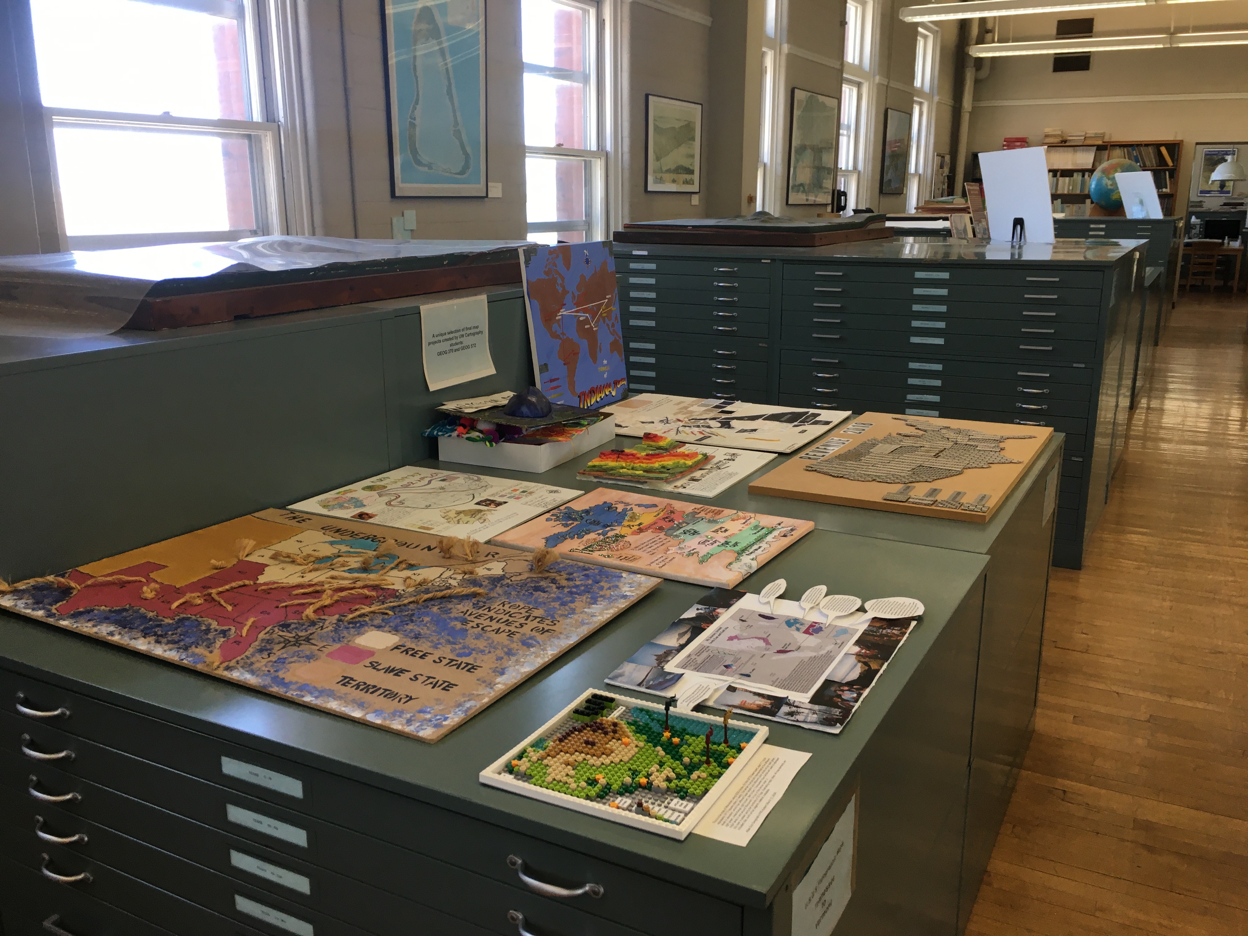
![]() The map is currently archived and on display in the
Arthur H. Robinson Map Library
located at the 3rd floor of historic
Science Hall
(550 N Park St, Madison, WI 53706).
The map is currently archived and on display in the
Arthur H. Robinson Map Library
located at the 3rd floor of historic
Science Hall
(550 N Park St, Madison, WI 53706).
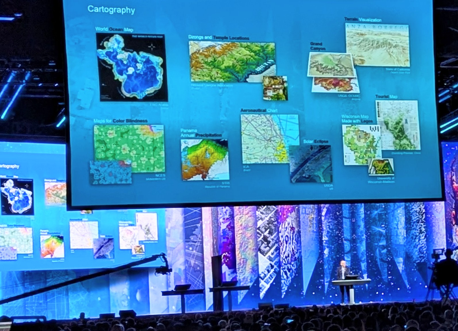
During Esri User Conference in July 2024, this map was selected by Esri's President Jack Dangermond to
be featured during the
Plenary Session.
In September 2024, this map won the Commended Award of
Garsdale Design Award for
3D Mapping, by British Cartographic Society.
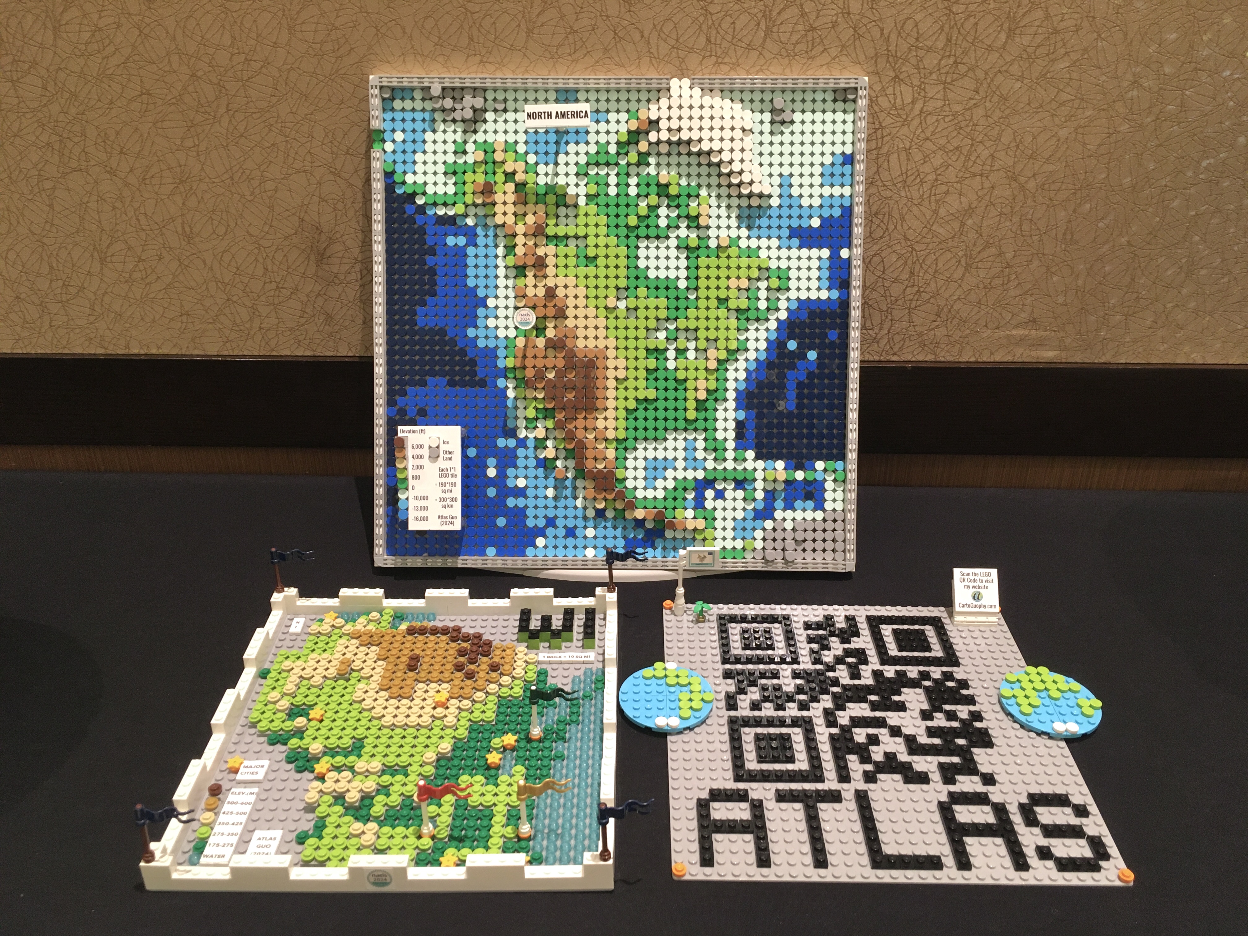
An upgraded version of the physical LEGO map was displayed in the Map Gallery of North American Cartographic Information Society 2024 Annual Conference at Tacoma, Washington.
This map is also selected to be published on the next volume (Vol.40) of Esri Map Book, in 2025.
Click to view more of my LEGO-Style maps !