Sun Yat-sen University
Centenary Memorial Map
《世纪中大 · 山高水长》
中山大学百年华诞纪念地图
The Centenary Legacy of Sun Yat-sen University:
Soaring Peaks, Everlasting Streams
Runner-Up of Reference Map Award in WLIA 2025 Map Contest
威斯康星州土地信息协会 2025年地图比赛参考地图类第二名
 Download Compressed Image
下载压缩图片
Download Full-Size Image
下载高清图片
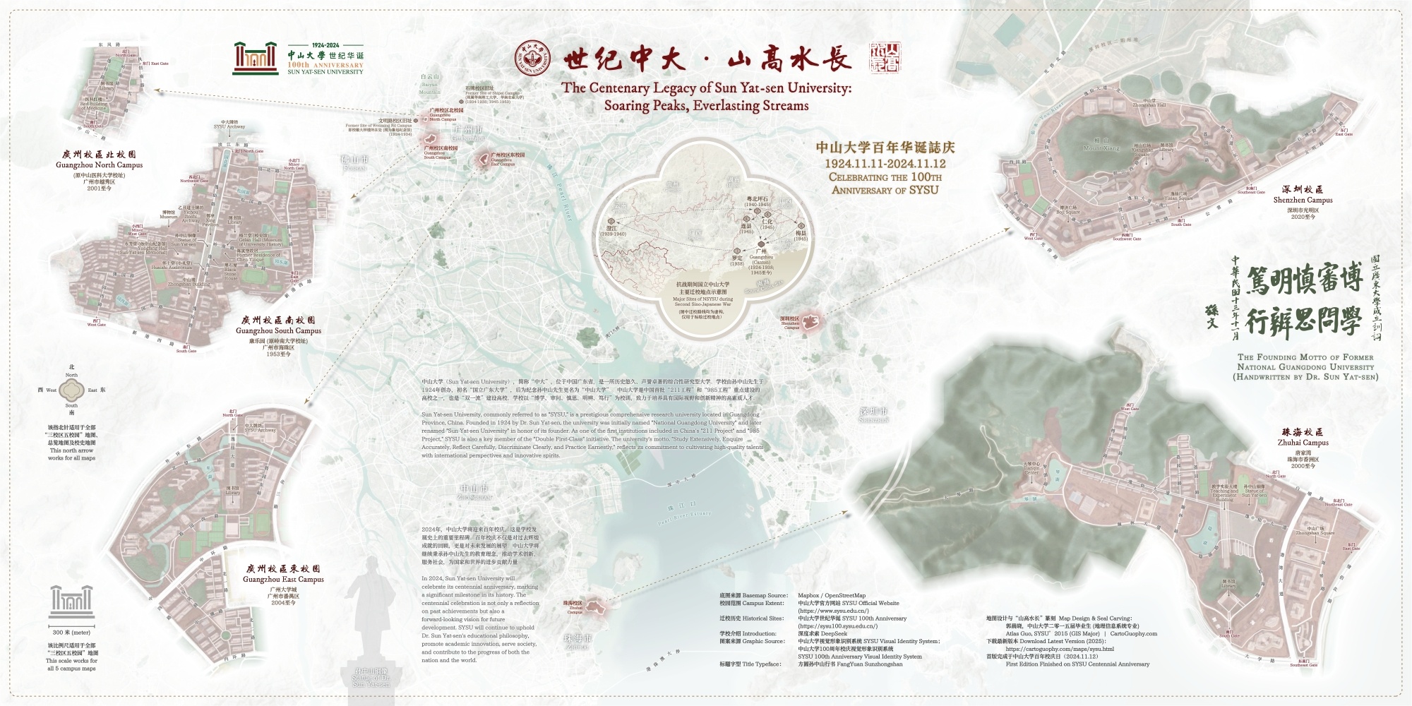
This bilingual commemorative map celebrates the 100th anniversary of Sun Yat-sen University, not only
showcasing its geographical layout but also weaving in rich historical and
cultural elements. It reflects the university’s remarkable century-long journey of growth and
achievement.
这幅中山大学百年校庆纪念地图在展示各个校区地理分布的同时,融入了丰富的历史文化元素,反映了学校历经百年的发展历程和瞩目成就。
The map illustrates the five campuses spanning three cities in Guangdong Province: Guangzhou (South,
North, and East Campuses), Zhuhai, and Shenzhen. Key features such as campus
gates, main streets, landmarks, and major bodies of water are clearly labeled.
地图展示了中山大学在广东省的五个校区,分别分布在广州(南、北、东校区)、珠海和深圳三座城市。各校校区的校门、主要街道、地标、水域等主要地物进行了清晰标绘。
An inset map, positioned slightly above the center, provides a brief account of the university’s
relocation during the Second Sino-Japanese War, highlighting its resilience and
commitment to education during turbulent times.
位于地图中部偏上方的一张插图简要介绍了中山大学在抗日战争期间的搬迁,展现了学校在动荡时期的对教育事业的坚韧。
Designed in an elegant ink-wash style, the map integrates Sun Yat-sen University’s signature colors—dark
red and deep green—blending geographical accuracy with the refined aesthetics
of traditional Chinese art. The base map was created in Mapbox using data from OpenStreetMap.
Additionally, motifs from the university’s emblem, such as the begonia-shaped window
design, are subtly incorporated into key elements, including the compass rose, inset map frame, and
point symbols.
地图采用优雅的水墨风格设计,融合了中山大学的标志性颜色——暗红色和深绿色,将地理空间准确性与中国传统艺术美学融为一体。基础底图是在Mapbox中使用
OpenStreetMap的开源数据创建。此外,学校的校徽图案(例如秋海棠形窗户设计)巧妙地融入了关键元素中,包括指北针、插图框架和点状符号等。
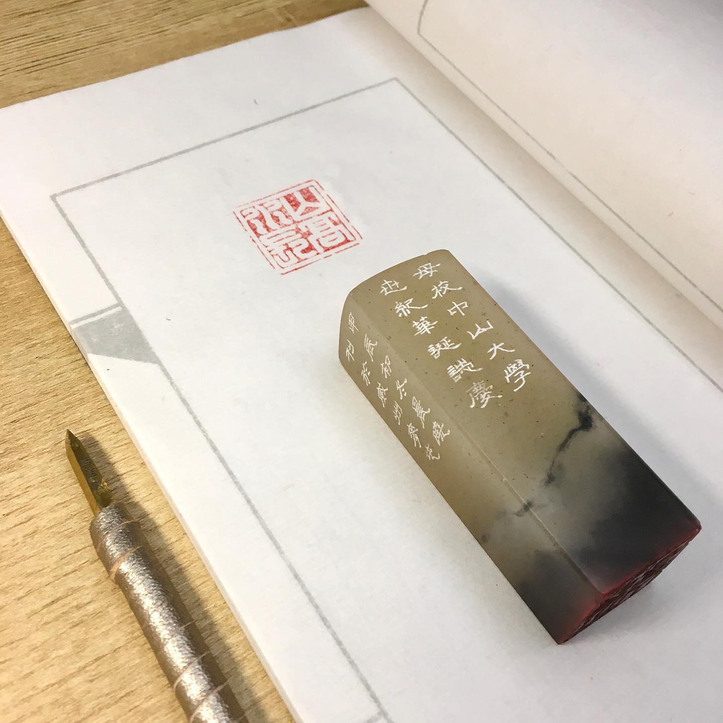
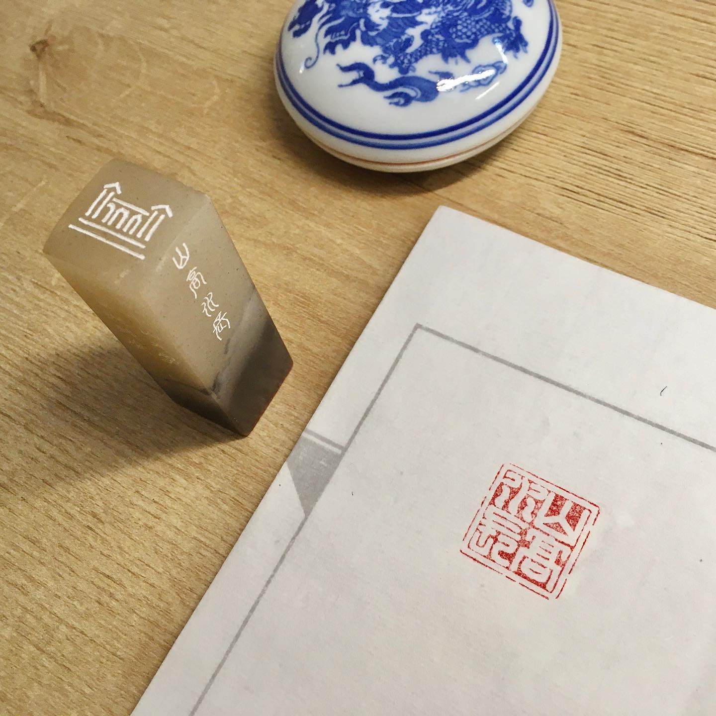
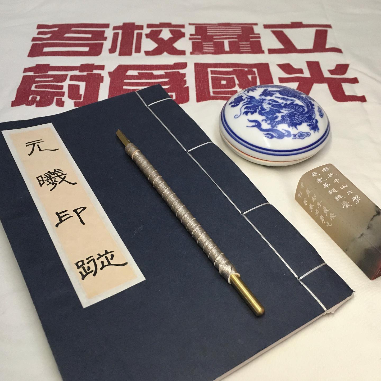
As a 2015 GIS graduate of Sun Yat-sen University, I present this map as a heartfelt tribute to my alma
mater’s centennial celebration. To further enhance its significance, I have
also carved a seal featuring the phrase "Soaring Peaks, Everlasting Streams"—a symbol of the
university’s enduring spirit—serving as the finishing touch to this commemorative piece.
作为中山大学 2015
届地理信息系统专业的毕业生,我在母校百年校庆之际精心制作了这张地图。为了进一步完善视觉效果,我还刻了一方印章作为点缀,上面刻有“山高水长”——这是中山大学校友之歌的名字,也是重要的精神象征。
Below is the graphic of the carved seal 山高水长 (Soaring Peaks, Everlasting Streams) embedded into the map:
下图为地图中嵌入的“山高水长”篆刻印章图案:

Below is a video (YouTube, Bilibili) of the SYSU alumni song (山高水长), in which I played the low/high
whistles and cajon box drum.
以下视频为哨笛版的中山大学校友之歌(即第二校歌)《山高水长》。我将自己演奏的低音与高音哨笛与箱鼓声道与原音频、视频进行了混合。
Click
to know more about the 100th anniversary of SYSU (English Version).
点击了解更多关于中山大学百年校庆的信息。
In Feb 2025, this map won the 2nd Place of Base & Reference Map Award during Wisconsin Land Information
Association (WLIA) 2025 Annual Conference Map Contest.
在2025年2月的威斯康星土地信息协会年会中,本地图荣获大会地图比赛参考地图类第二名。

If you have any suggestions towards this map(s), please share your feedback below. My
latest works and updates will be posted on the main social
media platforms. Thank you so much for your
support!
若您对本地图的设计或内容有任何建议,欢迎在下方留言区(姓名、邮箱、内容)提交反馈,期待与您进一步交流。最新作品与动态会在主要社交媒体平台上更新,非常感谢您的关注与支持!
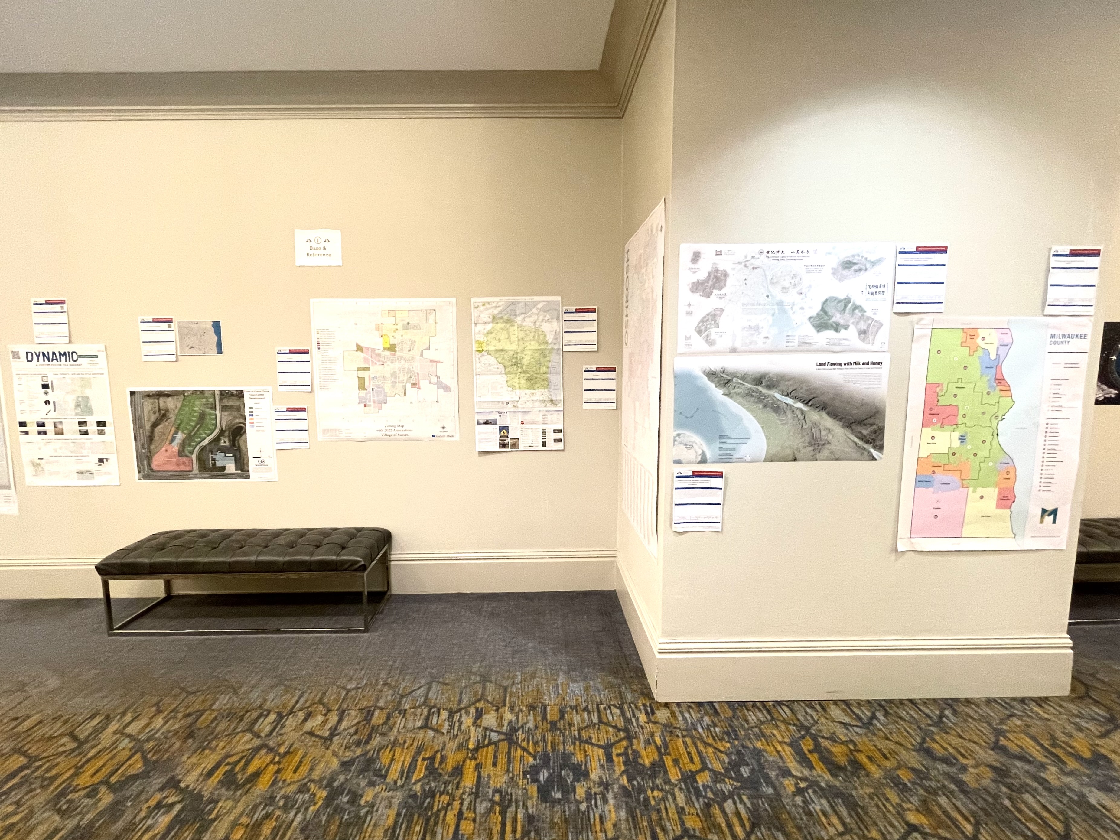
This map was displayed in the map gallery (map poster) of North American Cartographic Information Society (NACIS) 2025 annual meeting at Louisiville, KY (Oct 15-17). Check out my other entries in the map gallery!