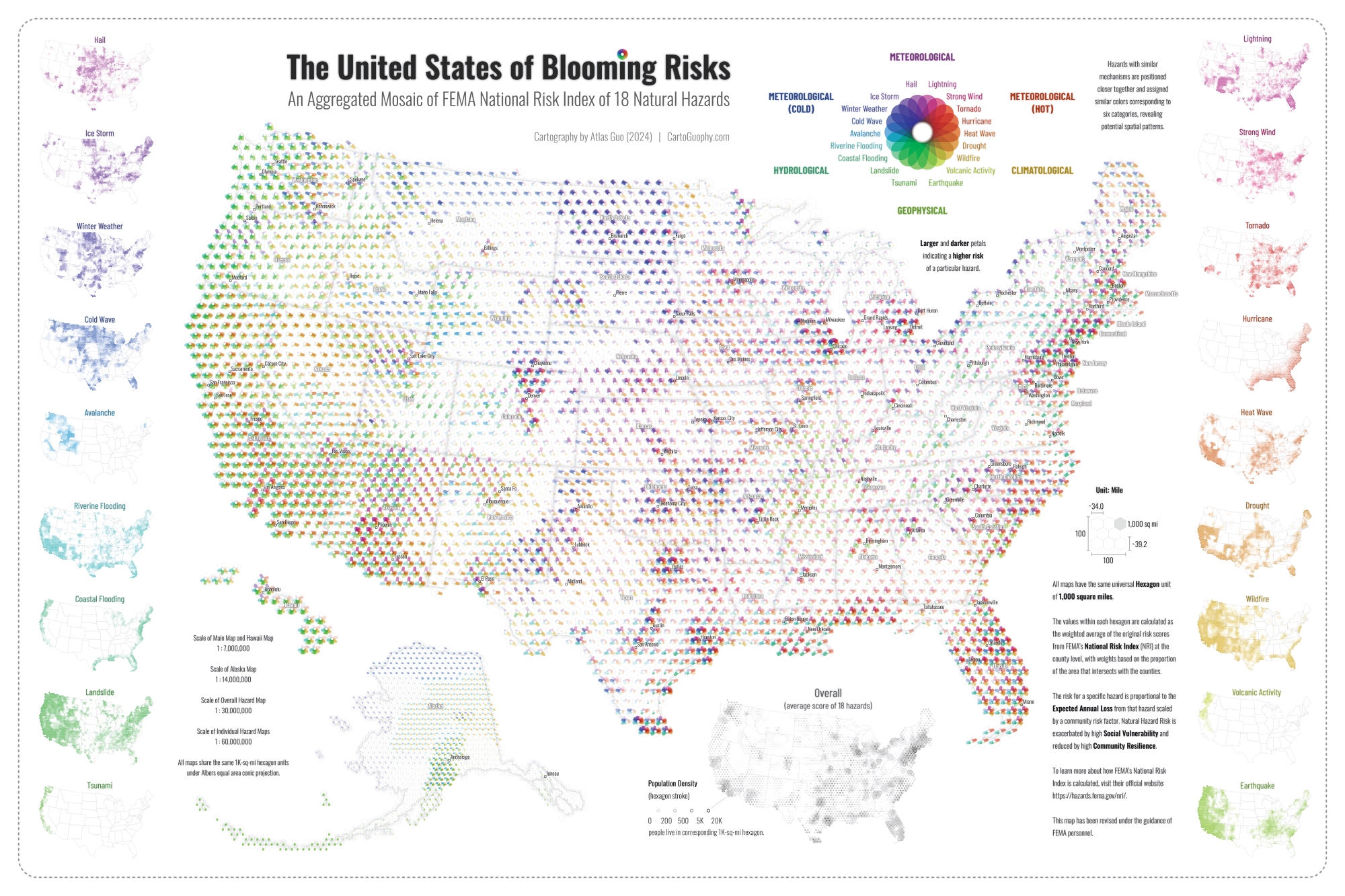
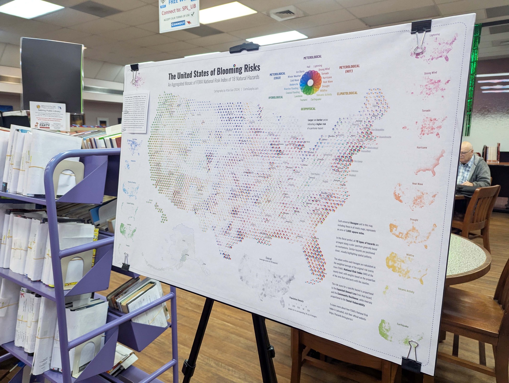
United States of Blooming Risks
An Aggregated Mosaic of FEMA National Risk Index of 18 Natural Hazards; Sister Map of "United States of
Natural Disasters" (in NACIS 2024 Map Gallery);
Best Thematic Map Award in WLIA 2025 Map Contest; Featured in local libraries
 Download Compressed Image
Download Full-Size Image
This comprehensive visualization of 18 U.S. natural hazards is a "sister map" of the award-winning map
The United States of
Natural Disasters.
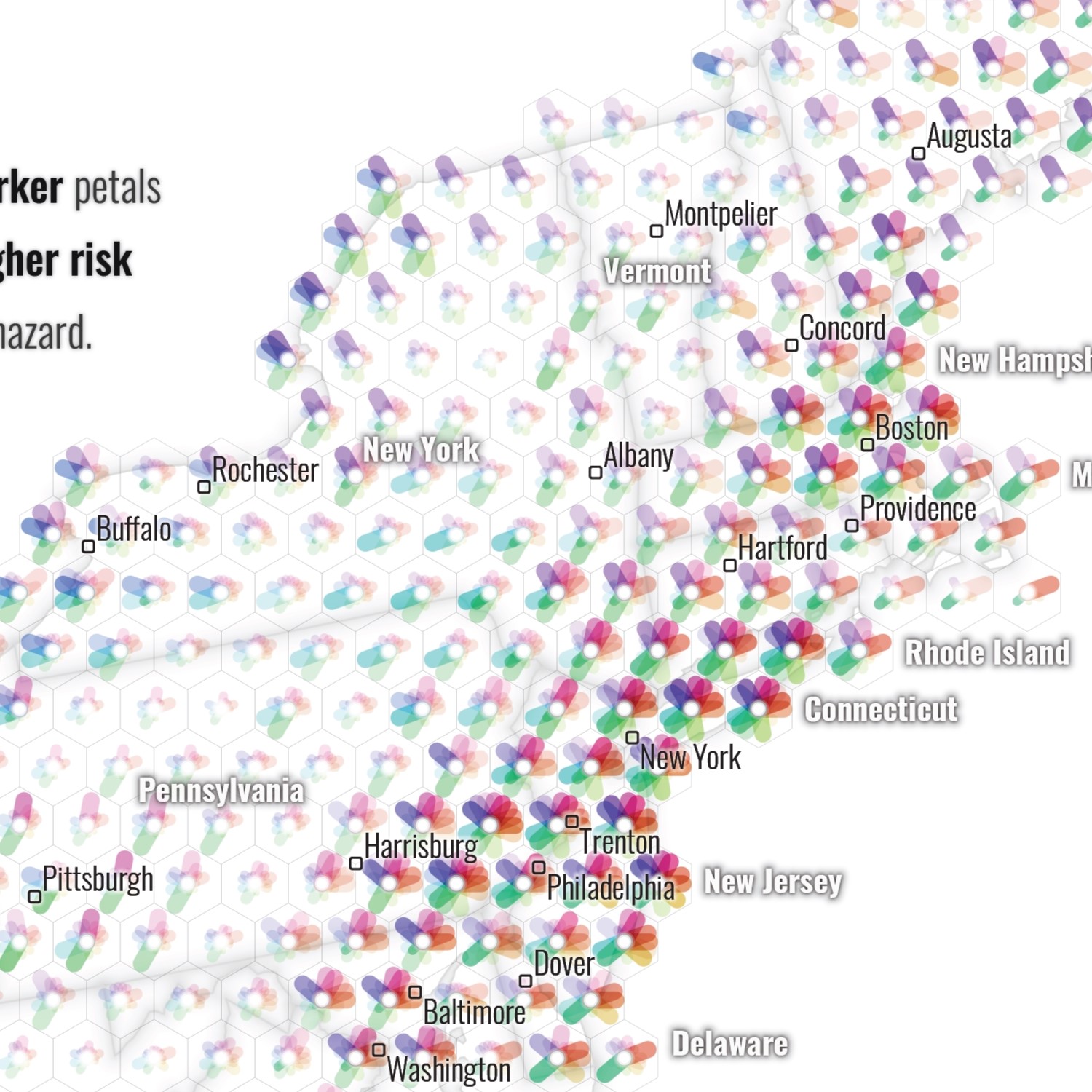
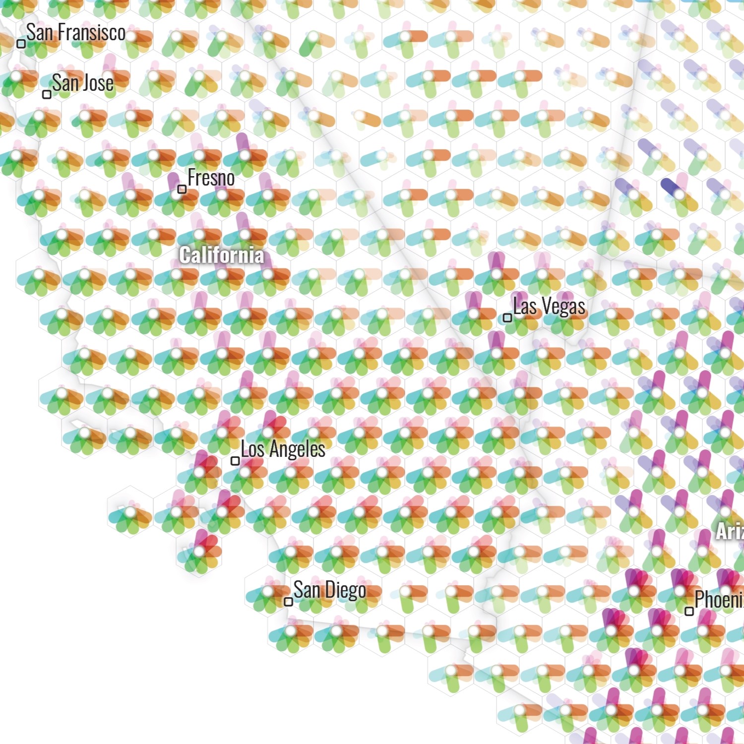
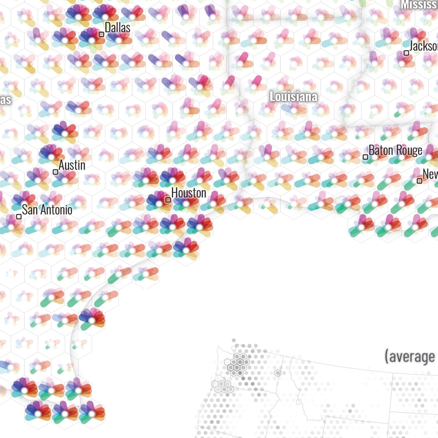
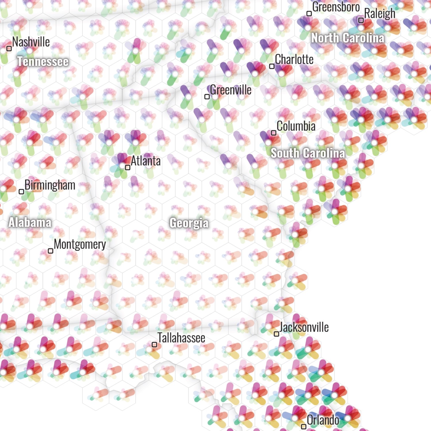
Each universal hexagon unit in this map, including those in all inset maps, represents an area of 1,000
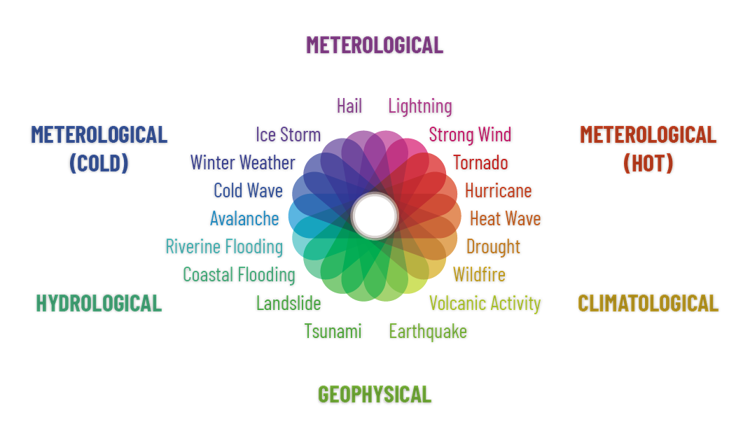
square miles. In this floral symbol, all 18 types of hazards are arranged
along a color spectrum based on their mechanisms. Similar hazards are positioned closer, visually
highlighting potential spatial patterns. Larger and darker petals represent a higher
risk for a particular natural hazard.
The values within each hexagon are calculated as the weighted average of the original risk scores from
FEMA’s
National Risk Index (NRI)
at the county level, with weights based on the proportion of the area that intersects with the counties.
The risk score for a specific hazard is proportional to the expected annual loss from that hazard, and
the community resilience, while inversely proportional to the social
vulnerability. To learn more about how FEMA's National Risk Index is calculated, visit their
website.
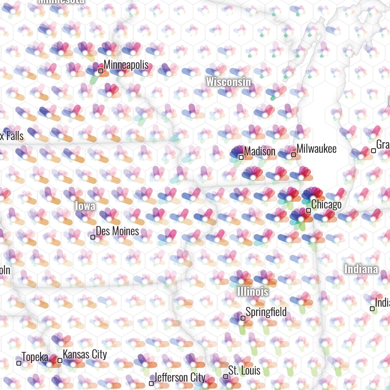
Below are some trimmed images of different regions of the contiguous United States:
Northwest: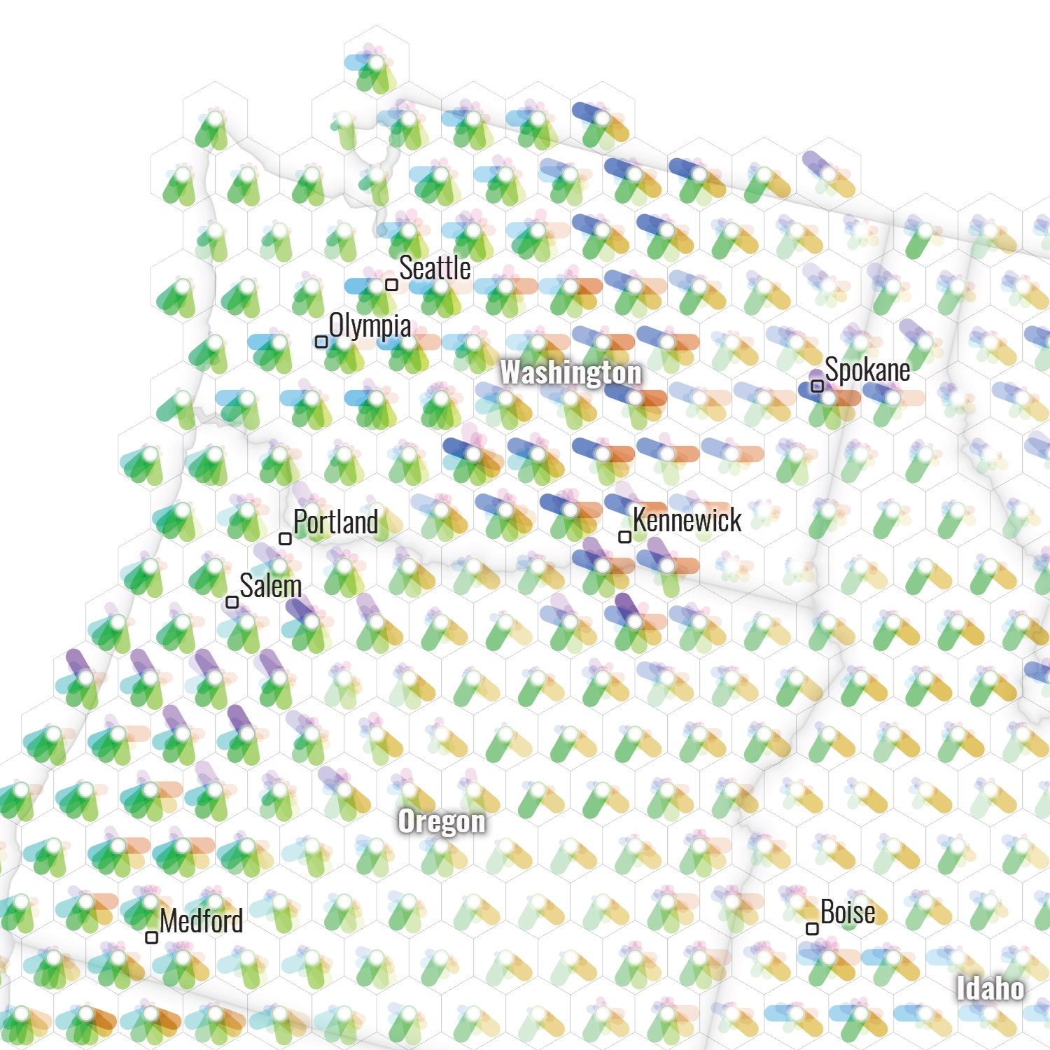 Midwest:
 Northeast:
 Southwest:
 South:
 Southeast:
A printed version of this map was displayed in the Map Gallery of North American Cartographic Information Society 2024 Annual Conference at Tacoma, Washington.

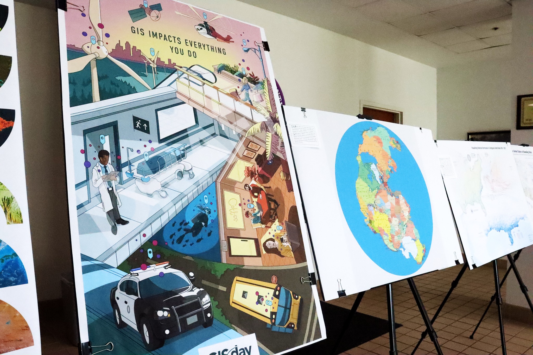
This map was selected by the Highlands County (FL) Board of County Commissioners, to be featured in the traveling "Map Expo" for public educational purpose. The exhibition was firstly on display in the government building for GIS Day, and then moved to 3 public libraries till mid-December.
Dates & Locations of "2024 Map Expo":
1. Government Center lobby, Nov. 18-22, 2024
(600 S. Commerce Ave., Sebring)
2. Avon Park Public Library, Nov. 25-27, 2024
(100 N. Museum Ave., Avon Park)
3. Sebring Public Library, Dec. 2-8, 2024
(319 W. Center Ave., Sebring)
4. Lake Placid Memorial Library, Dec. 10-15, 2024
(205 W. Interlake Blvd., Lake Placid)


In Feb 2025, this map won the Best Thematic Map Award during Wisconsin Land Information Association (WLIA) 2025 Annual Conference Map Contest.