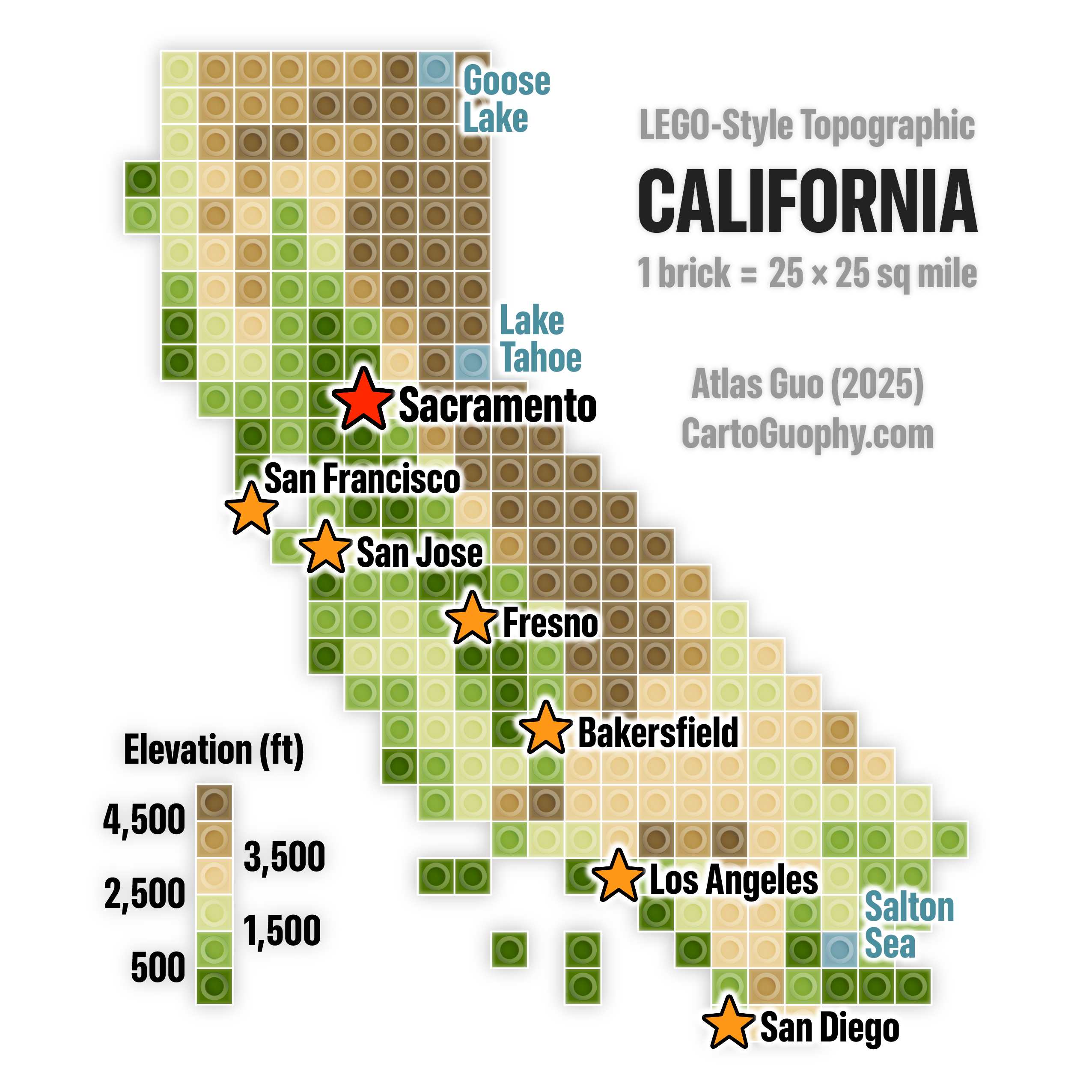
LEGO Style Topographic Map of California
Pixelated topographic map with each brick representing 25*25 square miles
 Download Full-Size Image
In this LEGO-style map of California, the terrain is represented at six levels in elevation, shaded in classic topographic color scheme. On top of the terrain, a major city layer is added using star symbols. In this map, each 1*1 LEGO unit represents 25*25 square miles horizontally, while labels of major cities and lakes are added.
Click to view this Apple-Themed Topographic Map of California, and more of my LEGO-Style maps!
This map was displayed in the map gallery (postcard / tiny map) of North American Cartographic Information Society (NACIS) 2025 annual meeting at Louisiville, KY (Oct 15-17). Check out my other entries in the map gallery!