A Mini Gallery of LEGO Style Topographic Maps
Assorted LEGO Style maps with various design styles (in NACIS 2024 Map Gallery)
Runner-Up of Mapping Poster Award in WLIA 2025 Map Contest
 Download Compressed Image
Download Full-Size Image
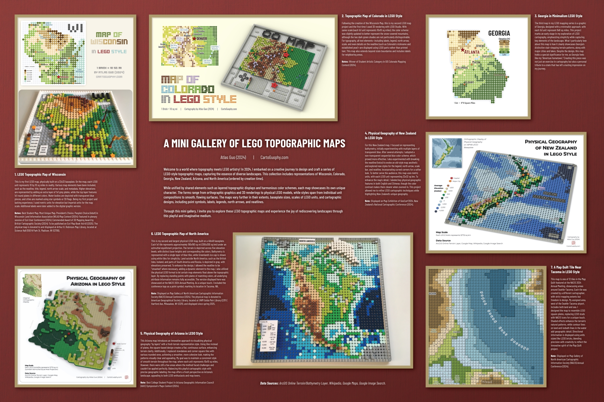
In the recent half year, I designed and created a series of LEGO style topographic maps, some of which have won several awards, making me realize that many others might share the same interest. Therefore, I compiled these attempts into this mini gallery.
Chronologically, these maps are: Wisconsin, Colorado, Georgia, New Zealand, Arizona, North America, and a piece of map quilt (click to view their individual pages).
While they do share some common features, such as layered topographic display and a majority of color scheme, each map is distinctly different from the others in various aspects, such as: representing form (orthographic graphic, 3D rendered image, physical LEGO object), style (individual round, curly surface), extent (region only, region in a bounding box), baseplate size and scale (how large one unit represents), point symbol, labeling, legend, north arrow, neatline, etc. I hope you find some joy in these LEGO maps!
(Data Source: ArcGIS Online Terrain/Bathymetry Layer, Wikipedia, Google Map, Google Image Search)
A printed version of this map was displayed in the Map Gallery of North American Cartographic Information Society 2024 Annual Conference at Tacoma, Washington.
Below is the 8-minute presentation titled " LEGO Topographic Mapping " during NACIS 2024 Conference's Practical Cartography Day:
Additionally, I gave another hour-long presentation titled " LEGO Style Topographic Mapping: A Case of Colorado " for GIS Colorado's Geo-Ruckus monthly lecture series.
This map won the 2nd Place of Mapping Poster Award during Wisconsin Land Information Association (WLIA) 2025 Annual Conference Map Contest.

Click to view more of my LEGO-Style maps !